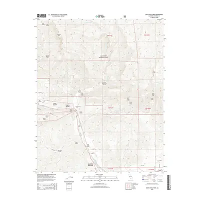
2015 Map of Santa Paula Peak
USGS Topo · Published 2015About this map
Howell Place and the surrounding wilderness of the Los Padres National Forest dominate this 2015 study of the Santa Paula region. The landscape is defined by the steep drainage of Santa Paula Cr, which carves through the mountains toward the settlement of Santa Paula at the southern edge of the sheet. Grounded in 2012 imagery, the map provides a precise record of rural land use and forest management, including small outposts like Camp Bartlett and the thermal landscape of Sulphur Springs. These features illustrate the intersection of private historical holdings and protected federal lands in Ventura County.
Find a feature on this map
4 named features on this map. Tap any name to fly to it.
Don’t see what you’re looking for? This feature index may not catch every label — zoom into the map to look around manually.
Map Details
Editions of this 2015 Santa Paula Peak Map
This is the sole edition of this map. No revisions or reprints were ever made.
Other maps of this area

1900 · Piru
USGS Topo · 1:62,500

1903 · Santa Paula
USGS Topo · 1:62,500

1903 · Mt. Pinos
USGS Topo · 1:125,000

1903 · Tejon
USGS Topo · 1:125,000

1903 · Camulos
USGS Topo · 1:125,000

1921 · Piru
USGS Topo · 1:62,500

1941 · Piru
USGS Topo · 1:62,500

1942 · Santa Paula
USGS Topo · 1:62,500

1943 · Topatopa Mountains
USGS Topo · 1:24,000

1943 · Lion Canyon
USGS Topo · 1:24,000