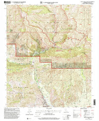
1995 Map of Santa Paula Peak
USGS Topo · Published 2000About this map
Santa Paula Peak Lookout dominates the eastern ridge of this mid-1990s survey, overlooking a landscape defined by rugged mountain terrain and legacy petroleum extraction. The intersection of public lands and private historic holdings is evident through the boundaries of the Ojai Grant and Ex Mission San Buenaventura Grant, which neighbor the protected wilds of the Sespe Wilderness. The southern portion of the map shows the transition into the valley near Santa Paula, featuring the Mupu School and several active clusters of oil wells and oil tanks concentrated around Saltmarsh Canyon and Adams Canyon.
Find a feature on this map
38 named features on this map. Tap any name to fly to it.
Don’t see what you’re looking for? This feature index may not catch every label — zoom into the map to look around manually.
Map Details
Editions of this 1995 Santa Paula Peak Map
This is the sole edition of this map. No revisions or reprints were ever made.
Other maps of this area

1900 · Piru
USGS Topo · 1:62,500

1903 · Santa Paula
USGS Topo · 1:62,500

1903 · Mt. Pinos
USGS Topo · 1:125,000

1903 · Tejon
USGS Topo · 1:125,000

1903 · Camulos
USGS Topo · 1:125,000

1921 · Piru
USGS Topo · 1:62,500

1941 · Piru
USGS Topo · 1:62,500

1942 · Santa Paula
USGS Topo · 1:62,500

1943 · Topatopa Mountains
USGS Topo · 1:24,000

1943 · Lion Canyon
USGS Topo · 1:24,000