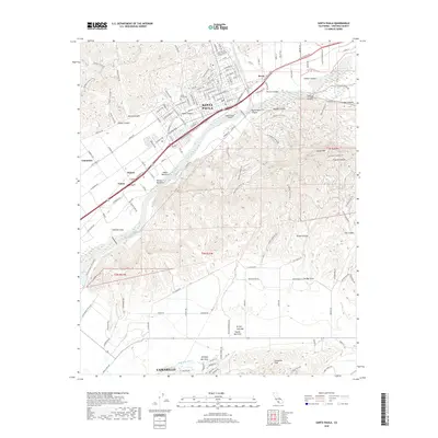
2018 Map of Santa Paula
USGS Topo · Published 2018About this map
The Santa Clara River valley defines this Ventura County landscape, where agriculture and urban growth meet at the foot of South Mtn. The city of Santa Paula serves as a regional hub, connected to outlying settlements like Kevet and the agricultural lands of Limoneira. The map shows a transition from the dense street grids of the valley floor to the deeply etched drainage systems of the surrounding highlands, including Adams Canyon and the notable Fox Barranca. Genealogists and local historians will find significant landmarks such as the Santa Paula Cem and the Santa Paula Airport, while the southern portion of the sheet captures the edge of Camarillo and the rising Camarillo Hills. This contemporary record preserves the complex network of local roads like W Telegraph Rd and irrigation features like Beardsley Wash that support the local economy.
Find a feature on this map
154 named features on this map. Tap any name to fly to it.
Don’t see what you’re looking for? This feature index may not catch every label — zoom into the map to look around manually.
Map Details
Editions of this 2018 Santa Paula Map
This is the sole edition of this map. No revisions or reprints were ever made.
Other maps of this area

1900 · Triunfo Pass
USGS Topo · 1:62,500

1900 · Piru
USGS Topo · 1:62,500

1903 · Santa Paula
USGS Topo · 1:62,500

1903 · Camulos
USGS Topo · 1:125,000

1904 · Hueneme
USGS Topo · 1:62,500

1921 · Piru
USGS Topo · 1:62,500

1921 · Triunfo Pass
USGS Topo · 1:62,500

1941 · Piru
USGS Topo · 1:62,500

1942 · Santa Paula
USGS Topo · 1:62,500

1942 · Hueneme
USGS Topo · 1:62,500