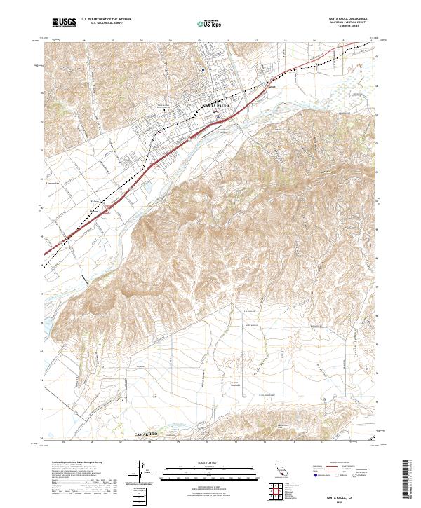
2022 Map of Santa Paula
USGS Topo · Published 2022About this map
Santa Paula serves as the focal point of this coastal California landscape, situated at the confluence of Santa Paula Creek and the Santa Clara River. The terrain is defined by a series of deep canyons and barrancas, including Adams Canyon and Fagan Canyon to the north, while the southern reaches rise into the Camarillo Hills and South Mountain. The regional transportation network is anchored by the Santa Paula Fwy and legacy routes like Telegraph Rd, reflecting the area's ongoing agricultural and industrial importance. Local history is preserved in landmarks such as the Pierce Brothers Santa Paula Cem and the Santa Paula Airport. The map also captures smaller agrarian settlements like Limoneira and Haines, while the northern edge of Camarillo appears near Beardsley Wash, illustrating the connectivity between these Ventura County communities.
Find a feature on this map
62 named features on this map. Tap any name to fly to it.
Don’t see what you’re looking for? This feature index may not catch every label — zoom into the map to look around manually.
Map Details
Editions of this 2022 Santa Paula Map
This is the sole edition of this map. No revisions or reprints were ever made.
Other maps of this area

1900 · Triunfo Pass
USGS Topo · 1:62,500

1900 · Piru
USGS Topo · 1:62,500

1903 · Santa Paula
USGS Topo · 1:62,500

1903 · Camulos
USGS Topo · 1:125,000

1904 · Hueneme
USGS Topo · 1:62,500

1921 · Piru
USGS Topo · 1:62,500

1921 · Triunfo Pass
USGS Topo · 1:62,500

1941 · Piru
USGS Topo · 1:62,500

1942 · Santa Paula
USGS Topo · 1:62,500

1942 · Hueneme
USGS Topo · 1:62,500