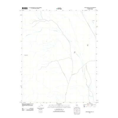
2012 Map of Santa Rosa Flat
USGS Topo · Published 2012About this map
Santa Rosa Flat defines this high desert landscape in Inyo County, where drainage systems and unpaved transit routes intersect. The map illustrates a network of ephemeral watercourses, primarily the extensive Santa Rosa Wash and the northern Lee Wash, which have carved paths through the arid terrain. The presence of White Mountain Talc Rd points to the region's historical mining activity, serving as a reminder of the industrial reach into these secluded basins. Elevations are punctuated by the Santa Rosa Hills and the prominent Malpais Mesa, creating a stark geography that separates Lee Flat from the larger valley system. This 2012 USGS survey provides a detailed view of the infrastructure supporting the area, including the intersection of Santa Rosa Rd and Saline Valley Rd, which remain critical for navigating this portion of the California desert.
Find a feature on this map
9 named features on this map. Tap any name to fly to it.
Don’t see what you’re looking for? This feature index may not catch every label — zoom into the map to look around manually.
Map Details
Editions of this 2012 Santa Rosa Flat Map
This is the sole edition of this map. No revisions or reprints were ever made.
Other maps of this area

1908 · Ballarat
USGS Topo · 1:250,000

1913 · Ballarat
USGS Topo · 1:250,000

1948 · Death Valley
USGS Topo · 1:250,000

1950 · Darwin
USGS Topo · 1:62,500

1950 · New York Butte
USGS Topo · 1:62,500

1950 · Ubehebe Peak
USGS Topo · 1:62,500

1951 · New York Butte
USGS Topo · 1:62,500

1951 · Darwin
USGS Topo · 1:62,500

1951 · Ubehebe Peak
USGS Topo · 1:62,500

1951 · Keeler
USGS Topo · 1:62,500