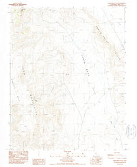
1987 Map of Santa Rosa Flat
USGS Topo · Published 1987About this map
Santa Rosa Mines serves as a primary point of interest on this 1980s topographic sheet, situated at the rugged intersection of the Inyo Mountains and the Malpais Mesa. The landscape is defined by its mining activity, with visible Tailings and various Prospect locations scattered across the high desert terrain. This era of surveying captures the region's character as a site of continued extraction and geological exploration.
Find a feature on this map
35 named features on this map. Tap any name to fly to it.
Don’t see what you’re looking for? This feature index may not catch every label — zoom into the map to look around manually.
Map Details
Editions of this 1987 Santa Rosa Flat Map
This is the sole edition of this map. No revisions or reprints were ever made.
Other maps of this area

1908 · Ballarat
USGS Topo · 1:250,000

1913 · Ballarat
USGS Topo · 1:250,000

1948 · Death Valley
USGS Topo · 1:250,000

1950 · Darwin
USGS Topo · 1:62,500

1950 · New York Butte
USGS Topo · 1:62,500

1950 · Ubehebe Peak
USGS Topo · 1:62,500

1951 · New York Butte
USGS Topo · 1:62,500

1951 · Darwin
USGS Topo · 1:62,500

1951 · Ubehebe Peak
USGS Topo · 1:62,500

1951 · Keeler
USGS Topo · 1:62,500