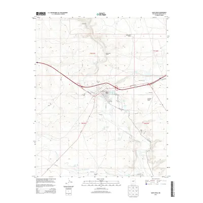
2013 Map of Santa Rosa
USGS Topo · Published 2013About this map
Pecos River hydrology and the legacy of mid-century highway travel define this portrait of eastern New Mexico. The town of Santa Rosa serves as a central hub where the Historic Route 66 corridor intersects with modern infrastructure. This 2013 survey provides a clear view of the area's unique sinkholes and lakes, including the famed Blue Hole, Hidden Lake, and Perch Lake. These natural features, alongside Agua Negra Springs to the south, illustrate the subterranean water systems that have sustained ranching and settlement in this arid landscape for generations.
Find a feature on this map
51 named features on this map. Tap any name to fly to it.
Don’t see what you’re looking for? This feature index may not catch every label — zoom into the map to look around manually.
Map Details
Editions of this 2013 Santa Rosa Map
This is the sole edition of this map. No revisions or reprints were ever made.
Other maps of this area

1892 · Corazon
USGS Topo · 1:125,000

1894 · Corazon
USGS Topo · 1:125,000

1954 · Santa Fe
USGS Topo · 1:250,000

1954 · Fort Sumner
USGS Topo · 1:250,000

1958 · Fort Sumner
USGS Topo · 1:250,000

1958 · Santa Fe
USGS Topo · 1:250,000

1963 · Colonias
USGS Topo · 1:24,000

1963 · Santa Rosa
USGS Topo · 1:24,000

1963 · Puerto Creek
USGS Topo · 1:24,000

1963 · Sunshine Mesa
USGS Topo · 1:24,000