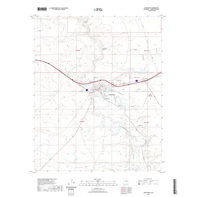
2020 Map of Santa Rosa
USGS Topo · Published 2020About this map
Santa Rosa serves as the focal point of this survey, situated at a critical crossing of the Pecos River and the legendary Hst Rte 66. The town's layout is defined by its relation to the water, with the Guadalupe County Courthouse positioned near a network of natural spring-fed features including the Blue Hole, Park Lake, and the complex of basins to the south such as Bass Lake and Swan Lake. These natural aquifers, including Agua Negra Springs and Bass Lake Springs, contrast sharply with the surrounding arid terrain of Rattlesnake Canyon and Table Mtn.
Find a feature on this map
61 named features on this map. Tap any name to fly to it.
Don’t see what you’re looking for? This feature index may not catch every label — zoom into the map to look around manually.
Map Details
Editions of this 2020 Santa Rosa Map
This is the sole edition of this map. No revisions or reprints were ever made.
Other maps of this area

1892 · Corazon
USGS Topo · 1:125,000

1894 · Corazon
USGS Topo · 1:125,000

1954 · Santa Fe
USGS Topo · 1:250,000

1954 · Fort Sumner
USGS Topo · 1:250,000

1958 · Fort Sumner
USGS Topo · 1:250,000

1958 · Santa Fe
USGS Topo · 1:250,000

1963 · Colonias
USGS Topo · 1:24,000

1963 · Santa Rosa
USGS Topo · 1:24,000

1963 · Puerto Creek
USGS Topo · 1:24,000

1963 · Sunshine Mesa
USGS Topo · 1:24,000