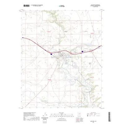
2023 Map of Santa Rosa
USGS Topo · Published 2023About this map
The Pecos River carves a winding path through this high-desert landscape, anchoring the development of Santa Rosa and its surrounding communities. The town's historic core is marked by the Guadalupe County Courthouse and a series of burial grounds that speak to the area's long-established heritage, including Saint Rose of Lima Cem, Evergreen Cem, and La Morada Cem. The presence of several natural springs and lakes, such as the famous Blue Hole, Hidden Lake, and Agua Negra Springs, highlights the unique hydrology of the region, which supported the early settlement at Canoncitos and the later growth of the town. Modern infrastructure like the Santa Rosa Route 66 Airport and a dense network of roads, including Hst Rte 66 and Spirithaven Loop, illustrate the area's continued role as a significant regional hub.
Find a feature on this map
63 named features on this map. Tap any name to fly to it.
Don’t see what you’re looking for? This feature index may not catch every label — zoom into the map to look around manually.
Map Details
Editions of this 2023 Santa Rosa Map
This is the sole edition of this map. No revisions or reprints were ever made.
Other maps of this area

1892 · Corazon
USGS Topo · 1:125,000

1894 · Corazon
USGS Topo · 1:125,000

1954 · Santa Fe
USGS Topo · 1:250,000

1954 · Fort Sumner
USGS Topo · 1:250,000

1958 · Fort Sumner
USGS Topo · 1:250,000

1958 · Santa Fe
USGS Topo · 1:250,000

1963 · Colonias
USGS Topo · 1:24,000

1963 · Santa Rosa
USGS Topo · 1:24,000

1963 · Puerto Creek
USGS Topo · 1:24,000

1963 · Sunshine Mesa
USGS Topo · 1:24,000