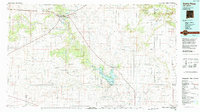
1984 Map of Santa Rosa
USGS Topo · Published 1992About this map
The Pecos River carves a vital corridor through this High Plains landscape, flowing south from Santa Rosa toward the expansive waters of Lake Sumner. This 1980s survey illustrates a region defined by its water sources and transit routes, where the Southern Pacific railroad and major highways like Interstate 40 intersect near the Pecos. The map reveals the layout of local landmarks including the Blue Hole and Park Lake, alongside the small riverside settlement of Puerto de Luna.
Find a feature on this map
60 named features on this map. Tap any name to fly to it.
Don’t see what you’re looking for? This feature index may not catch every label — zoom into the map to look around manually.
Map Details
Editions of this 1984 Santa Rosa Map
This is the sole edition of this map. No revisions or reprints were ever made.
Other maps of this area

1890 · Bernal
USGS Topo · 1:125,000

1891 · Bernal
USGS Topo · 1:125,000

1892 · Corazon
USGS Topo · 1:125,000

1894 · Corazon
USGS Topo · 1:125,000

1894 · Bernal
USGS Topo · 1:125,000

1930 · Tucumcari
USGS Topo · 1:125,000

1954 · Santa Fe
USGS Topo · 1:250,000

1954 · Fort Sumner
USGS Topo · 1:250,000

1954 · Tucumcari
USGS Topo · 1:250,000

1954 · Clovis
USGS Topo · 1:250,000