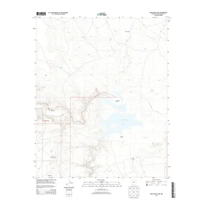
2013 Map of Santa Rosa Lake
USGS Topo · Published 2013About this map
Santa Rosa Lake dominates this Guadalupe County landscape, formed by the impoundment of the Pecos River. The map details the complex shoreline of the reservoir, including the prominent Horseshoe Bend and the drainage of Esteros Cr from the north. The area is characterized by scattered ranching outposts such as River Ranch, Shaw and Craig-Walker, and Reilly Ranch, reflecting the enduring pastoral use of this high plains terrain. Land use is further evidenced by a network of water management features essential for livestock, including Round Top Tank, North Tank, and the Oil Well Windmill. In the southern portion of the quadrangle, the settlement of Cañoncitos sits near the riverbanks, while northern elevations are marked by the dramatic incision of Box Canyon and the presence of Rock Hole Spring.
Find a feature on this map
18 named features on this map. Tap any name to fly to it.
Don’t see what you’re looking for? This feature index may not catch every label — zoom into the map to look around manually.
Map Details
Editions of this 2013 Santa Rosa Lake Map
This is the sole edition of this map. No revisions or reprints were ever made.
Other maps of this area

1892 · Corazon
USGS Topo · 1:125,000

1894 · Corazon
USGS Topo · 1:125,000

1954 · Santa Fe
USGS Topo · 1:250,000

1954 · Fort Sumner
USGS Topo · 1:250,000

1958 · Fort Sumner
USGS Topo · 1:250,000

1958 · Santa Fe
USGS Topo · 1:250,000

1963 · Colonias
USGS Topo · 1:24,000

1963 · Santa Rosa
USGS Topo · 1:24,000

1963 · Sunshine Mesa
USGS Topo · 1:24,000

1963 · Mesa Cherisco
USGS Topo · 1:24,000