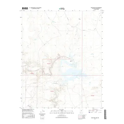
2017 Map of Santa Rosa Lake
USGS Topo · Published 2017About this map
Santa Rosa Lake dominates the central landscape of this Guadalupe County region, where the impounded waters of the Pecos River meet a complex network of canyons and drainage systems. This 2017 survey shows the modern topography of the reservoir, including the prominent Horseshoe Bend and the inflow of Esteros Cr. The surrounding high ground is defined by traditional ranching infrastructure and hydrological features such as Rock Hole Spring, Round Top Tank, and Bar Y Tank. To the southwest, the small settlement of Cañoncitos sits near Carmen RD, providing a point of human history in an otherwise open, water-focused environment. The map also traces the local transportation network through named thoroughfares like Joe 7 Louie Page Rd and Stuckeys Rd, which navigate the mesas and basins typical of the New Mexico interior.
Find a feature on this map
24 named features on this map. Tap any name to fly to it.
Don’t see what you’re looking for? This feature index may not catch every label — zoom into the map to look around manually.
Map Details
Editions of this 2017 Santa Rosa Lake Map
This is the sole edition of this map. No revisions or reprints were ever made.
Other maps of this area

1892 · Corazon
USGS Topo · 1:125,000

1894 · Corazon
USGS Topo · 1:125,000

1954 · Santa Fe
USGS Topo · 1:250,000

1954 · Fort Sumner
USGS Topo · 1:250,000

1958 · Fort Sumner
USGS Topo · 1:250,000

1958 · Santa Fe
USGS Topo · 1:250,000

1963 · Colonias
USGS Topo · 1:24,000

1963 · Santa Rosa
USGS Topo · 1:24,000

1963 · Sunshine Mesa
USGS Topo · 1:24,000

1963 · Mesa Cherisco
USGS Topo · 1:24,000