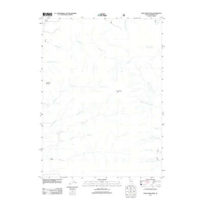
2011 Map of Santa Rosa Peak
USGS Topo · Published 2011About this map
Santa Rosa Peak anchors this high-elevation landscape in Humboldt County, defined by a radial drainage pattern of canyons and creeks. On the northwestern edge, the Roberti Ranch sits at the base of the mountains where the terrain begins its steep ascent toward peaks like Sawtooth Mountain. The map detail traces the complex network of seasonal and perennial waters, including the long reach of Rebel Creek and the southern flow of Rock Creek. These waterways, alongside McConnell Creek and Antelope Creek, cut through the desert landscape, illustrating the natural water management systems essential to Nevada's ranching and wilderness areas. Toward the southern end, Falls Canyon and North Fork Hanson Creek mark the descent into the lower basins, providing a clear record of the area's physical geography in the early 21st century.
Find a feature on this map
19 named features on this map. Tap any name to fly to it.
Don’t see what you’re looking for? This feature index may not catch every label — zoom into the map to look around manually.
Map Details
Editions of this 2011 Santa Rosa Peak Map
This is the sole edition of this map. No revisions or reprints were ever made.
Other maps of this area

1882 · Paradise
USGS Topo · 1:250,000

1893 · Paradise
USGS Topo · 1:250,000

1955 · McDermitt
USGS Topo · 1:250,000

1958 · Paradise Valley
USGS Topo · 1:62,500

1958 · Awakening Peak
USGS Topo · 1:62,500

1959 · McDermitt
USGS Topo · 1:250,000

1959 · Orovada
USGS Topo · 1:62,500

1959 · Hinkey Summit
USGS Topo · 1:62,500
1982 · Andorno Ranch
USGS Topo · 1:24,000
1985 · Osgood Mts
USGS Topo · 1:100,000