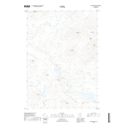
2019 Map of Santanoni Peak
USGS Topo · Published 2019About this map
The Santanoni Mountains dominate this high-peaks landscape, defined by prominent summits including Santanoni Peak, Panther Peak, and Couchsachraga Peak. This wilderness terrain in Essex County is carved by the Cold River, which flows past Millers Falls and Big Eddy in the northern reaches. The settlement pattern is almost entirely absent, characterized instead by a network of waterways and isolated peaks like Little Santanoni Mtn and Wolf Pond Mtn. A few primitive roads, such as Moose Pond Rd and Newcomb Lake Rd, provide limited access to the interior lakes, including Moose Pond and the expansive Newcomb Lake in the southeast. This survey captures the area's undeveloped character, where the Newcomb River and Santanoni Brook drain the steep slopes of the high Adirondack range.
Find a feature on this map
33 named features on this map. Tap any name to fly to it.
Don’t see what you’re looking for? This feature index may not catch every label — zoom into the map to look around manually.
Map Details
Editions of this 2019 Santanoni Peak Map
This is the sole edition of this map. No revisions or reprints were ever made.
Other maps of this area

1898 · Newcomb
USGS Topo · 1:62,500

1901 · Newcomb
USGS Topo · 1:62,500

1903 · Blue Mountain
USGS Topo · 1:62,500

1904 · Santanoni
USGS Topo · 1:62,500

1904 · Long Lake
USGS Topo · 1:62,500

1948 · Ogdensburg
USGS Topo · 1:250,000

1950 · Utica
USGS Topo · 1:250,000

1951 · Ogdensburg
USGS Topo · 1:250,000

1953 · Ogdensburg
USGS Topo · 1:250,000

1953 · Santanoni
USGS Topo · 1:62,500