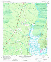
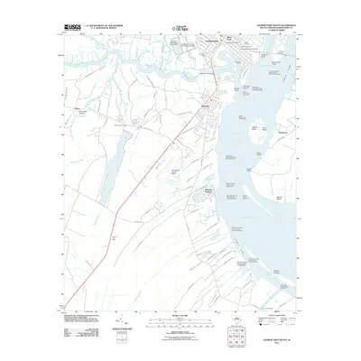
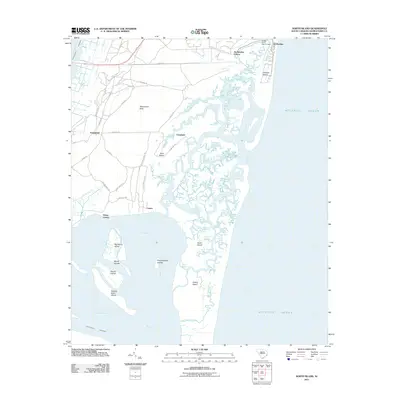
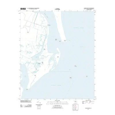
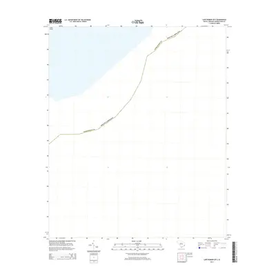
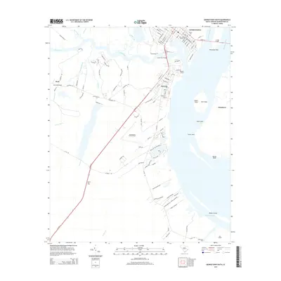
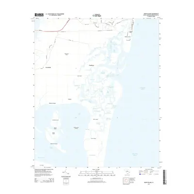
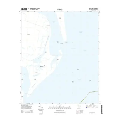
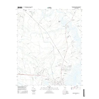
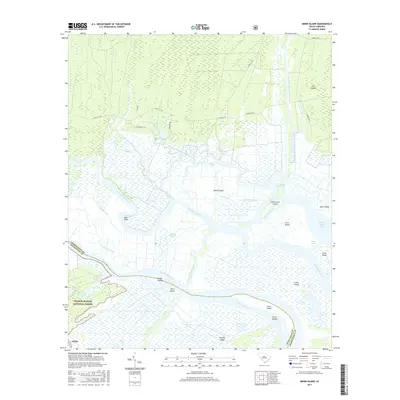
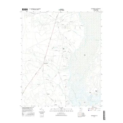
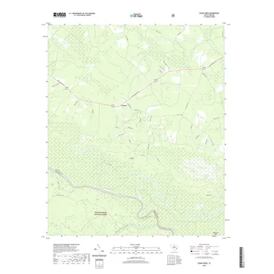
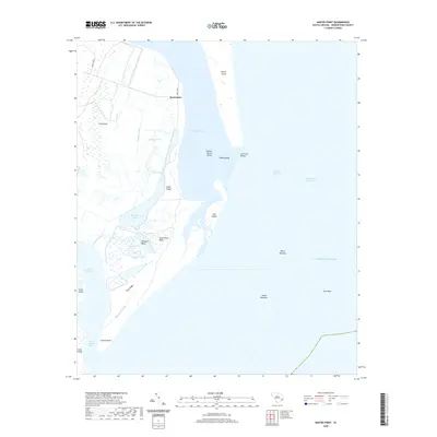
1942 Map of Santee Point
USGS Topo · Published 1976About this map
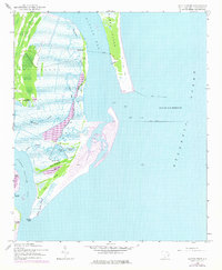
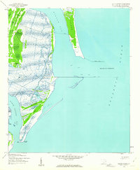
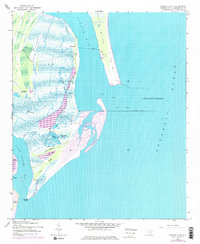
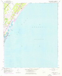
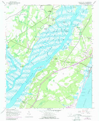
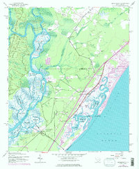
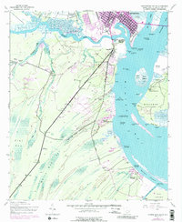
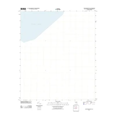
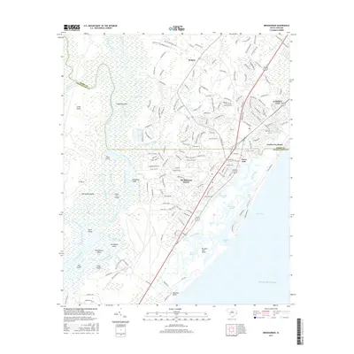
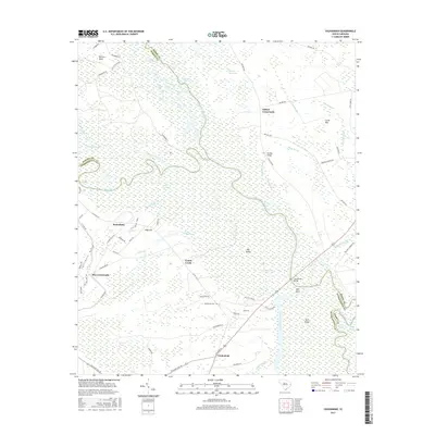
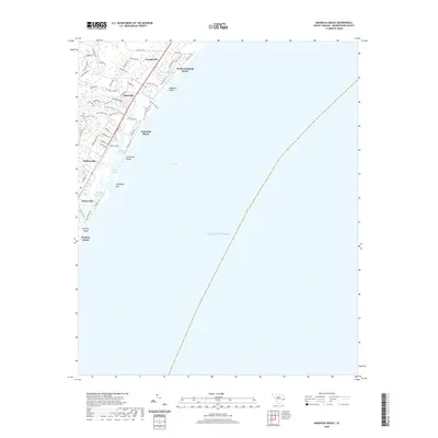
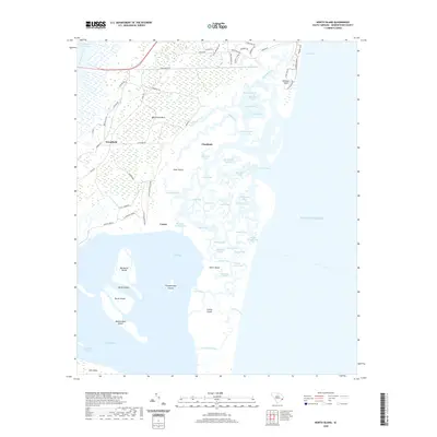
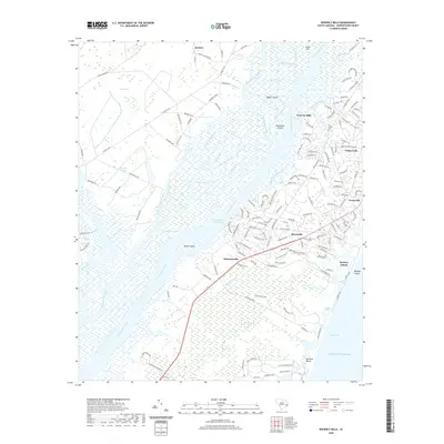
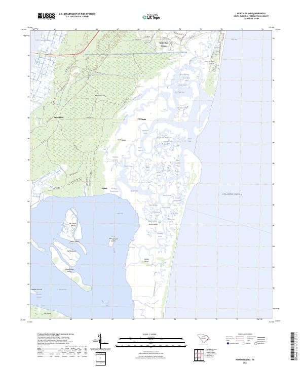
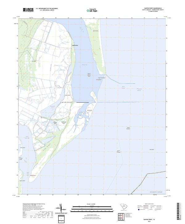
Cat Island and South Island dominate this coastal landscape where the waters of Winyah Bay meet the Atlantic Ocean. During the early 1940s, this area remained largely defined by its natural topography and early maritime infrastructure, including the protective North Jetty and South Jetty at the Winyah Bay Entrance. Inland, the presence of the Cat Island Plantation and a designated Quarantine station near Mosquito Creek point to the historic land use and navigational controls of the Georgetown coast. The topography reveals a complex network of tidal waterways such as Lagoon Creek and Beach Creek, surrounding interior features like Wheeler Basin and the elevated Pine Ridge. These details provide a look at the barrier island system before late-twentieth-century changes shifted the shoreline and marsh drainage patterns.
Find a feature on this map
26 named features on this map. Tap any name to fly to it.
Don’t see what you’re looking for? This feature index may not catch every label — zoom into the map to look around manually.
Map Details
Editions of this 1942 Santee Point Map
3 editions found
Historical Maps of Quarantine Through Time
104 maps found

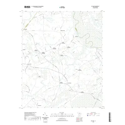
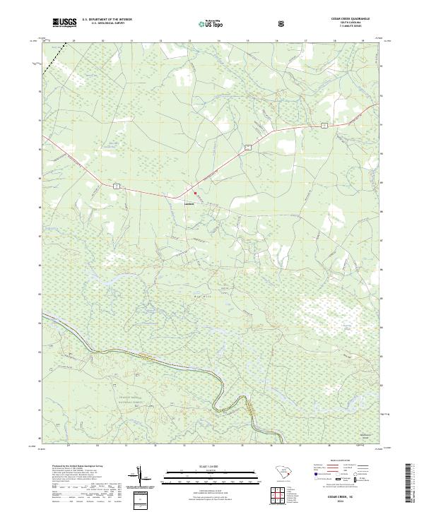
1942 Cedar Creek
Georgetown County, SC
1942 Magnolia Beach
Georgetown County, SC

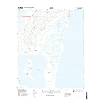
1942 North Island
Georgetown County, SC
1942 Santee Point
Georgetown County, SC
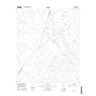
1942 Waverly Mills
Georgetown County, SC
1943 Brookgreen
Georgetown County, SC
1943 Carvers Bay
Georgetown County, SC
1943 Georgetown North
Georgetown County, SC
1943 Georgetown South
Georgetown County, SC
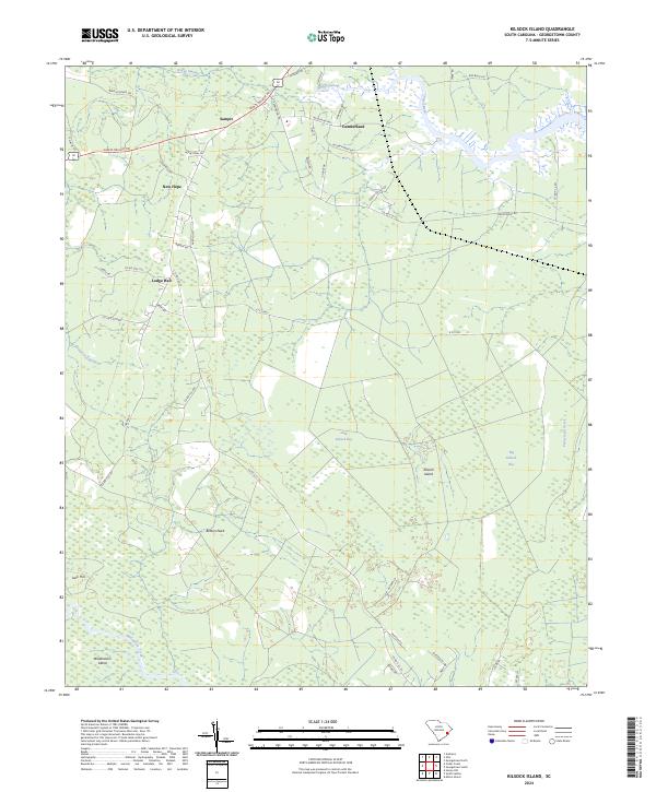
1943 Kilsock Bay
Georgetown County, SC
1943 Minim Island
Georgetown County, SC
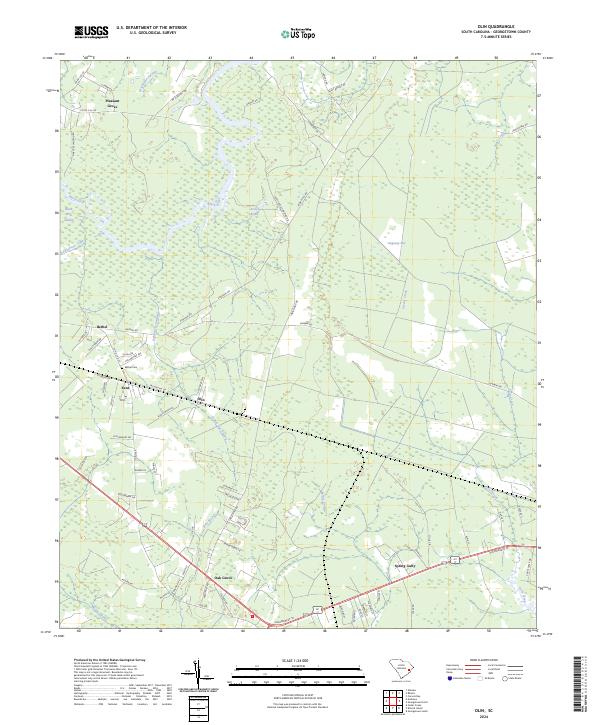
1943 Olin
Georgetown County, SC

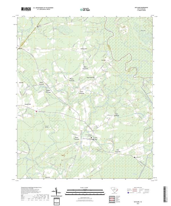
1943 Outland
Georgetown County, SC
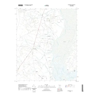
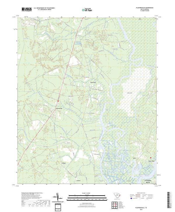
1943 Plantersville
Georgetown County, SC
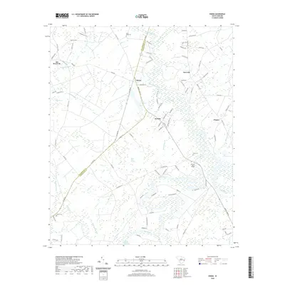
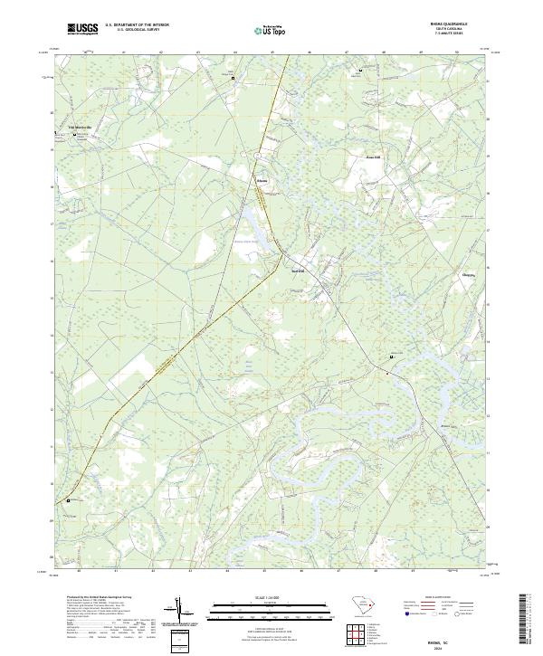
1943 Rhems
Georgetown County, SC
1943 Yauhannah
Georgetown County, SC

1944 Outland
Georgetown County, SC

1947 Georgetown South
Georgetown County, SC

1968 Georgetown South
Georgetown County, SC
2011 Brookgreen
Georgetown County, SC
2011 Cape Romain OE E
Georgetown County, SC
2011 Carvers Bay
Georgetown County, SC
2011 Cedar Creek
Georgetown County, SC
2011 Georgetown North
Georgetown County, SC
2011 Georgetown South
Georgetown County, SC
2011 Kilsock Island
Georgetown County, SC
2011 Magnolia Beach
Georgetown County, SC
2011 Minim Island
Georgetown County, SC
2011 North Island
Georgetown County, SC
2011 Olin
Georgetown County, SC
2011 Outland
Georgetown County, SC
2011 Plantersville
Georgetown County, SC

2011 Rhems
Georgetown County, SC
2011 Santee Point
Georgetown County, SC
2011 Waverly Mills
Georgetown County, SC
2011 Yauhannah
Georgetown County, SC
2014 Brookgreen
Georgetown County, SC
2014 Cape Romain OE E
Georgetown County, SC
2014 Carvers Bay
Georgetown County, SC
2014 Cedar Creek
Georgetown County, SC
2014 Georgetown North
Georgetown County, SC
2014 Georgetown South
Georgetown County, SC
2014 Kilsock Island
Georgetown County, SC
2014 Magnolia Beach
Georgetown County, SC
2014 Minim Island
Georgetown County, SC
2014 North Island
Georgetown County, SC
2014 Olin
Georgetown County, SC
2014 Outland
Georgetown County, SC
2014 Plantersville
Georgetown County, SC
2014 Rhems
Georgetown County, SC
2014 Santee Point
Georgetown County, SC
2014 Waverly Mills
Georgetown County, SC
2014 Yauhannah
Georgetown County, SC
2017 Brookgreen
Georgetown County, SC
2017 Cape Romain OE E
Georgetown County, SC
2017 Carvers Bay
Georgetown County, SC
2017 Cedar Creek
Georgetown County, SC
2017 Georgetown North
Georgetown County, SC
2017 Georgetown South
Georgetown County, SC
2017 Kilsock Island
Georgetown County, SC
2017 Magnolia Beach
Georgetown County, SC
2017 Minim Island
Georgetown County, SC
2017 North Island
Georgetown County, SC
2017 Olin
Georgetown County, SC
2017 Outland
Georgetown County, SC
2017 Plantersville
Georgetown County, SC
2017 Rhems
Georgetown County, SC
2017 Santee Point
Georgetown County, SC
2017 Waverly Mills
Georgetown County, SC
2017 Yauhannah
Georgetown County, SC
2020 Brookgreen
Georgetown County, SC
2020 Cape Romain OE E
Georgetown County, SC
2020 Carvers Bay
Georgetown County, SC
2020 Cedar Creek
Georgetown County, SC
2020 Georgetown North
Georgetown County, SC
2020 Georgetown South
Georgetown County, SC
2020 Kilsock Island
Georgetown County, SC
2020 Magnolia Beach
Georgetown County, SC
2020 Minim Island
Georgetown County, SC
2020 North Island
Georgetown County, SC
2020 Olin
Georgetown County, SC
2020 Outland
Georgetown County, SC
2020 Plantersville
Georgetown County, SC
2020 Rhems
Georgetown County, SC
2020 Santee Point
Georgetown County, SC
2020 Waverly Mills
Georgetown County, SC
2020 Yauhannah
Georgetown County, SC

2024 Brookgreen
Georgetown County, SC
2024 Cape Romain OE E
Georgetown County, SC
2024 Carvers Bay
Georgetown County, SC
2024 Cedar Creek
Georgetown County, SC

2024 Georgetown North
Georgetown County, SC

2024 Georgetown South
Georgetown County, SC
2024 Kilsock Island
Georgetown County, SC

2024 Magnolia Beach
Georgetown County, SC
2024 Minim Island
Georgetown County, SC
2024 North Island
Georgetown County, SC
2024 Olin
Georgetown County, SC
2024 Outland
Georgetown County, SC
2024 Plantersville
Georgetown County, SC
2024 Rhems
Georgetown County, SC
2024 Santee Point
Georgetown County, SC

2024 Waverly Mills
Georgetown County, SC
2024 Yauhannah
Georgetown County, SC