1976 Map of Santeetlah Creek
USGS Topo · Published 1978About this map
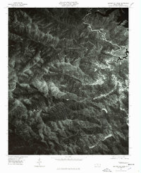
Santeetlah Lake borders the northeastern corner of this orthophotomap, showing the intricate shoreline and surrounding forested slopes as they appeared in the mid-1970s. This specialized map format, prepared from 1976 aerial photography, replaces traditional contour lines with high-resolution photographic detail, allowing for the direct observation of forest density, clearings, and the winding course of Santeetlah Creek through the mountainous terrain. The small settlement of Dentons is visible in the southern reaches, providing a localized point of interest for researchers studying the human footprint in the Snowbird Mountains. The lack of dense road networks or industrial development emphasizes the remote, undisturbed character of this North Carolina landscape, where land use was primarily defined by natural topography and water features during this era.
Find a feature on this map
4 named features on this map. Tap any name to fly to it.
Don’t see what you’re looking for? This feature index may not catch every label — zoom into the map to look around manually.
Map Details
Editions of this 1976 Santeetlah Creek Map
This is the sole edition of this map. No revisions or reprints were ever made.
Other maps of this area

1893 · Murphy
USGS Topo · 1:125,000

1914 · Murphy
USGS Topo · 1:125,000

1927 · Big Junction
USGS Topo · 1:24,000

1933 · Haw Knob
USGS Topo · 1:48,000

1933 · Whiteoak Flats
USGS Topo · 1:24,000

1934 · McDaniel Bald
USGS Topo · 1:24,000

1934 · Murphy
USGS Topo · 1:48,000

1935 · Robbinsville
USGS Topo · 1:24,000

1935 · Fontana
USGS Topo · 1:24,000

1935 · Marble
USGS Topo · 1:24,000