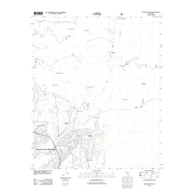
2012 Map of Santiago Peak
USGS Topo · Published 2012About this map
Santiago Peak dominates the high ground of the Santa Ana Mountains, serving as a focal point for this 2012 survey. The landscape is a study in contrasts, where the dense residential developments of Rancho Santa Margarita and Robinson Ranch push against the wilder, complex drainage basins of Arroyo Trabuco and Santiago Canyon. This era reflects the modern suburban footprint in southern California, yet it remains anchored by older ranching legacies like the Starr Ranch, Four S Ranch, and the Joplin Boys Ranch.
Find a feature on this map
75 named features on this map. Tap any name to fly to it.
Don’t see what you’re looking for? This feature index may not catch every label — zoom into the map to look around manually.
Map Details
Editions of this 2012 Santiago Peak Map
This is the sole edition of this map. No revisions or reprints were ever made.
Other maps of this area

1901 · Southern California Sheet No. 1
USGS Topo · 1:250,000

1901 · Elsinore
USGS Topo · 1:125,000

1901 · Riverside
USGS Topo · 1:62,500

1902 · Corona
USGS Topo · 1:125,000

1904 · Southern California Sheet No. 1
USGS Topo · 1:250,000

1935 · El Toro
USGS Topo · 1:31,680

1942 · Lake Elsinore
USGS Topo · 1:62,500

1942 · Santiago Peak
USGS Topo · 1:62,500

1942 · Corona
USGS Topo · 1:62,500

1942 · Riverside
USGS Topo · 1:62,500
Featured Places
- Mission Viejo, CA
- Lake Forest, CA
- Rancho Santa Margarita, CA
- Canyon Crest, Mission Viejo
- Coto de Caza, CA