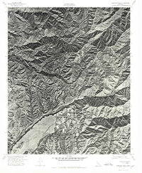
1974 Map of Santiago Peak
USGS Topo · Published 1975About this map
Santiago Peak dominates this 1974 orthophotoquad, which utilizes aerial imagery to document the Santa Ana Mountains before extensive late-twentieth-century development altered the surrounding Orange County landscape. The photographic detail reveals the complex network of ridgelines and drainage basins defined by Silverado Canyon to the north and Trabuco Canyon further south. Produced through collaboration between the Orange County Board of Supervisors and federal surveyors, this study provides a precise visual record of natural landforms and early access roads. The transition from the high summit down to the lower alluvial fans demonstrates the geological character of the region as it existed just before the rapid suburban expansion of the 1970s and 1980s, preserving the state of these canyons at a specific moment in California's land-use history.
Find a feature on this map
3 named features on this map. Tap any name to fly to it.
Don’t see what you’re looking for? This feature index may not catch every label — zoom into the map to look around manually.
Map Details
Editions of this 1974 Santiago Peak Map
This is the sole edition of this map. No revisions or reprints were ever made.
Other maps of this area

1901 · Southern California Sheet No. 1
USGS Topo · 1:250,000

1901 · Elsinore
USGS Topo · 1:125,000

1901 · Riverside
USGS Topo · 1:62,500

1902 · Corona
USGS Topo · 1:125,000

1904 · Southern California Sheet No. 1
USGS Topo · 1:250,000

1935 · El Toro
USGS Topo · 1:31,680

1942 · Lake Elsinore
USGS Topo · 1:62,500

1942 · Santiago Peak
USGS Topo · 1:62,500

1942 · Corona
USGS Topo · 1:62,500

1942 · Riverside
USGS Topo · 1:62,500
Featured Places
- Mission Viejo, CA
- Lake Forest, CA
- Rancho Santa Margarita, CA
- Portola Hills, Lake Forest
- Canyon Crest, Mission Viejo