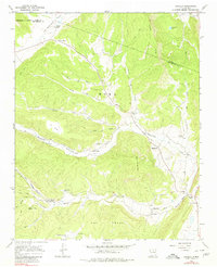
1965 Map of Sapello
USGS Topo · Published 1980About this map
Sapello and its neighboring valley settlements are shown here as they appeared in the mid-1960s, a landscape defined by traditional northern New Mexico land grants and small mountain communities. The geography is intricately bound by the Sapello Grant Boundary and the Las Vegas Grant Boundary, with the Sapello River and Manuelitas Creek serving as the primary lifelines for the area. The map reveals a high concentration of spiritual and commemorative sites, including the Brother of Jesus Mission and several community-specific cemeteries such as San Ignacio Cem and Santa Niño Cem. Steep terrain features like Fragoso Ridge and Cerro de la Cruz divide the narrow inhabited valleys, while numerous jeep trails navigate the high country toward San Isidro Lake. This survey provides a clear view of the rural habitation patterns before significant modernization, centered on small clusters of buildings and long-standing family ranching territories.
Find a feature on this map
36 named features on this map. Tap any name to fly to it.
Don’t see what you’re looking for? This feature index may not catch every label — zoom into the map to look around manually.
Map Details
Editions of this 1965 Sapello Map
2 editions found
Other maps of this area

1889 · Las Vegas
USGS Topo · 1:125,000

1891 · Las Vegas
USGS Topo · 1:125,000

1893 · Las Vegas
USGS Topo · 1:125,000

1954 · Santa Fe
USGS Topo · 1:250,000

1958 · Santa Fe
USGS Topo · 1:250,000

1961 · El Porvenir
USGS Topo · 1:24,000

1961 · Montezuma
USGS Topo · 1:24,000

1963 · Lake Isabel
USGS Topo · 1:24,000

1963 · Rainsville
USGS Topo · 1:24,000
1963 · Las Vegas NW
USGS Topo · 1:24,000