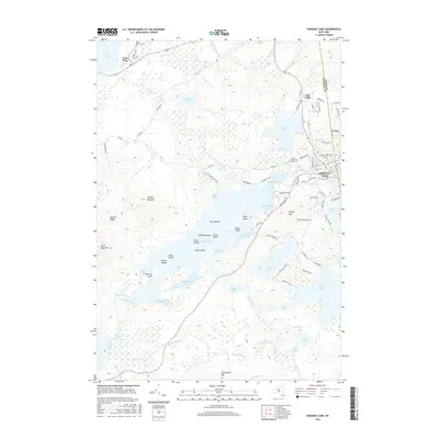
2016 Map of Saranac Lake
USGS Topo · Published 2016About this map
Saranac Lake and the surrounding Adirondack high country are defined by a complex network of glacial lakes and mountain peaks. This 2016 survey documents the village as it sits at the edge of Lake Flower, acting as a gateway to the extensive waterways of Lower Saranac Lake and Middle Saranac Lake. The map reveals a landscape where recreation and geography are inseparable, from the slopes of Mt Pisgah and Dewey Mtn to the many islands like Fern Island and Eagle Island that dot the lakes. The presence of Saint Bernards Cem and Saint Johns Cem provides essential points of reference for local genealogy, while the boundary between Essex and Franklin counties bisects the northeastern corner. Beyond the village, smaller settlements like Lake Clear and numerous ponds such as McCauley Pond and Kiwassa Lake illustrate the density of the region's hydrography.
Find a feature on this map
98 named features on this map. Tap any name to fly to it.
Don’t see what you’re looking for? This feature index may not catch every label — zoom into the map to look around manually.
Map Details
Editions of this 2016 Saranac Lake Map
This is the sole edition of this map. No revisions or reprints were ever made.
Other maps of this area

1902 · Saranac
USGS Topo · 1:62,500

1904 · Saranac
USGS Topo · 1:62,500

1904 · Santanoni
USGS Topo · 1:62,500

1904 · Long Lake
USGS Topo · 1:62,500

1905 · Saint Regis
USGS Topo · 1:62,500

1948 · Ogdensburg
USGS Topo · 1:250,000

1951 · Ogdensburg
USGS Topo · 1:250,000

1953 · Ogdensburg
USGS Topo · 1:250,000

1953 · Santanoni
USGS Topo · 1:62,500

1955 · Long Lake
USGS Topo · 1:62,500