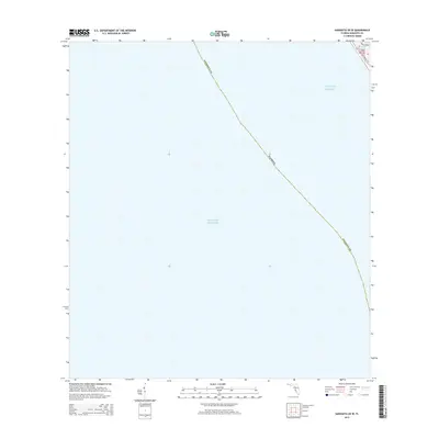
2015 Map of Sarasota OE W
USGS Topo · Published 2015About this map
The Gulf of Mexico dominates this coastal survey, where the maritime boundary of Florida sweeps across the open water. Most of the map area is dedicated to these offshore waters, illustrating the vast aquatic approach to the barrier islands. In the extreme northeastern corner, a sliver of land reveals the residential and transit corridor of Gulf of Mexico Dr as it follows the shoreline. This small terrestrial segment includes the protected waters of Bayou Sound, providing a precise look at the interface between the developed coast and the sea. The diagonal line of the Sarasota Co boundary serves as the primary geographic reference across the marine expanse, marking the jurisdictional divide within the gulf waters during the mid-2010s.
Find a feature on this map
9 named features on this map. Tap any name to fly to it.
Don’t see what you’re looking for? This feature index may not catch every label — zoom into the map to look around manually.
Map Details
Editions of this 2015 Sarasota OE W Map
This is the sole edition of this map. No revisions or reprints were ever made.
Other maps of this area

1944 · Bird Keys
USGS Topo · 1:31,680

1944 · Sarasota
USGS Topo · 1:31,680

1944 · Bradenton Beach
USGS Topo · 1:31,680

1947 · Bradenton
USGS Topo · 1:24,000

1956 · Tampa
USGS Topo · 1:250,000

1959 · Tampa
USGS Topo · 1:250,000

1960 · Tampa
USGS Topo · 1:250,000
1964 · Bradenton Beach
USGS Topo · 1:24,000
1964 · Bradenton
USGS Topo · 1:24,000

1972 · Tampa
USGS Topo · 1:250,000