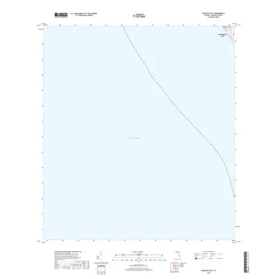
2018 Map of Sarasota OE W
USGS Topo · Published 2018About this map
Longboat Key occupies a narrow sliver of land in the northeastern corner of this coastal survey, where the barrier island meets the open waters of the Gulf of Mexico. This map primarily illustrates the maritime expanse off the Florida coast, with the land area limited to the northern reach of the key. Local geography is defined by Cranes Bayou, a sheltered water body tucked behind the primary Gulf-facing shoreline. The infrastructure of the late 2010s is represented by State Road 789, which serves as the primary corridor for the residential and resort developments along the island. This survey captures the precise relationship between the developed shoreline and the surrounding hydrography, providing a record of the island's footprint and the coastal boundary of t36s r17e before recent tidal shifts.
Find a feature on this map
5 named features on this map. Tap any name to fly to it.
Don’t see what you’re looking for? This feature index may not catch every label — zoom into the map to look around manually.
Map Details
Editions of this 2018 Sarasota OE W Map
This is the sole edition of this map. No revisions or reprints were ever made.
Other maps of this area

1944 · Bird Keys
USGS Topo · 1:31,680

1944 · Sarasota
USGS Topo · 1:31,680

1944 · Bradenton Beach
USGS Topo · 1:31,680

1947 · Bradenton
USGS Topo · 1:24,000

1956 · Tampa
USGS Topo · 1:250,000

1959 · Tampa
USGS Topo · 1:250,000

1960 · Tampa
USGS Topo · 1:250,000
1964 · Bradenton Beach
USGS Topo · 1:24,000
1964 · Bradenton
USGS Topo · 1:24,000

1972 · Tampa
USGS Topo · 1:250,000