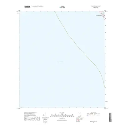
2021 Map of Sarasota OE W
USGS Topo · Published 2021About this map
Longboat Key defines the eastern edge of this coastal survey, where the barrier island meets the vast expanse of the Gulf of Mexico. The map details a thin strip of land along the Florida coast, focused on the northern reaches of the key. Local navigation and property boundaries are marked by the presence of Cranes Bayou, a small inlet providing sheltered water on the bayside of the island. The primary terrestrial thoroughfare, Gulf of Mexico Dr, runs parallel to the shoreline, serving as the spine for development in this part of Sarasota County. This document captures the modern layout of the key's narrow topography just as it transitions into the open gulf waters.
Find a feature on this map
6 named features on this map. Tap any name to fly to it.
Don’t see what you’re looking for? This feature index may not catch every label — zoom into the map to look around manually.
Map Details
Editions of this 2021 Sarasota OE W Map
This is the sole edition of this map. No revisions or reprints were ever made.
Other maps of this area

1944 · Bird Keys
USGS Topo · 1:31,680

1944 · Sarasota
USGS Topo · 1:31,680

1944 · Bradenton Beach
USGS Topo · 1:31,680

1947 · Bradenton
USGS Topo · 1:24,000

1956 · Tampa
USGS Topo · 1:250,000

1959 · Tampa
USGS Topo · 1:250,000

1960 · Tampa
USGS Topo · 1:250,000
1964 · Bradenton Beach
USGS Topo · 1:24,000
1964 · Bradenton
USGS Topo · 1:24,000

1972 · Tampa
USGS Topo · 1:250,000