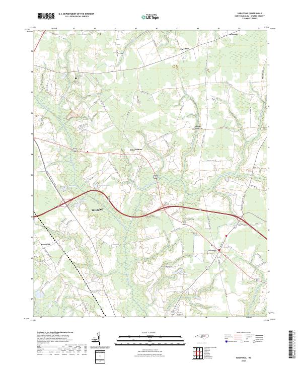
2022 Map of Saratoga
USGS Topo · Published 2022About this map
Saratoga and its surrounding rural landscapes in Wilson County are defined by a network of drainage systems and agricultural crossroads. The hydrology of the region is dominated by the sprawling Toisnot Swamp and Whiteoak Swamp, which feed into the larger Contentnea Creek at the southern edge of the sheet. These wetlands are punctuated by localized water bodies such as Edmunson Pond and Wainwright Pond, reflecting the historical importance of water management for local farming.
Find a feature on this map
73 named features on this map. Tap any name to fly to it.
Don’t see what you’re looking for? This feature index may not catch every label — zoom into the map to look around manually.
Map Details
Editions of this 2022 Saratoga Map
This is the sole edition of this map. No revisions or reprints were ever made.
Other maps of this area

1902 · Rocky Mount
USGS Topo · 1:62,500

1902 · Tarboro
USGS Topo · 1:62,500

1903 · Tarboro
USGS Topo · 1:62,500

1904 · Falkland
USGS Topo · 1:62,500

1904 · Rocky Mount
USGS Topo · 1:62,500

1904 · Wilson
USGS Topo · 1:62,500

1953 · Rocky Mount
USGS Topo · 1:250,000

1954 · Rocky Mount
USGS Topo · 1:250,000
1977 · Winstead Crossroads
USGS Topo · 1:24,000
1977 · Elm City
USGS Topo · 1:24,000