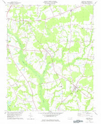
1978 Map of Saratoga
USGS Topo · Published 1978About this map
The town of Saratoga and its surrounding agricultural landscape in Wilson County define this 1970s survey. The terrain is deeply intertwined with a network of watercourses, including the broad Toisnot Swamp and Whiteoak Swamp, which weave through the low-lying coastal plain. Rural life is anchored by a dense distribution of country churches and community nodes such as Simmon Grove Ch, Rose Chapel, and the settlement of Wilbanks near the northern border.
Find a feature on this map
42 named features on this map. Tap any name to fly to it.
Don’t see what you’re looking for? This feature index may not catch every label — zoom into the map to look around manually.
Map Details
Editions of this 1978 Saratoga Map
This is the sole edition of this map. No revisions or reprints were ever made.
Other maps of this area

1902 · Rocky Mount
USGS Topo · 1:62,500

1902 · Tarboro
USGS Topo · 1:62,500

1903 · Tarboro
USGS Topo · 1:62,500

1904 · Falkland
USGS Topo · 1:62,500

1904 · Rocky Mount
USGS Topo · 1:62,500

1904 · Wilson
USGS Topo · 1:62,500

1953 · Rocky Mount
USGS Topo · 1:250,000

1954 · Rocky Mount
USGS Topo · 1:250,000
1977 · Winstead Crossroads
USGS Topo · 1:24,000
1977 · Elm City
USGS Topo · 1:24,000