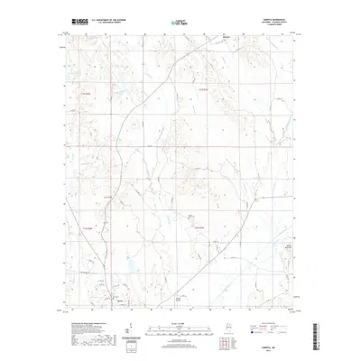
2021 Map of Sarepta
USGS Topo · Published 2021About this map
Sarepta and the outskirts of Bruce define the rural landscape of Calhoun County in this modern topographic study. The area is characterized by the meandering path of the Skuna River and its associated Old River Run, which influence the local drainage patterns alongside creeks like Cowpen Cr and Yoda Cr. This survey illustrates the persistence of small-scale aviation at Hasting Airpark and the geographic prominence of Johnny Main Mtn in the southeast.
Find a feature on this map
56 named features on this map. Tap any name to fly to it.
Don’t see what you’re looking for? This feature index may not catch every label — zoom into the map to look around manually.
Map Details
Editions of this 2021 Sarepta Map
This is the sole edition of this map. No revisions or reprints were ever made.
Other maps of this area

1953 · West Point
USGS Topo · 1:250,000

1954 · Pittsboro
USGS Topo · 1:62,500

1956 · Tupelo
USGS Topo · 1:250,000

1958 · Tupelo
USGS Topo · 1:250,000

1958 · West Point
USGS Topo · 1:250,000

1963 · West Point
USGS Topo · 1:250,000

1972 · Paris
USGS Topo · 1:24,000

1972 · Robbs
USGS Topo · 1:24,000
1972 · Banner
USGS Topo · 1:24,000

1972 · Vardaman
USGS Topo · 1:24,000