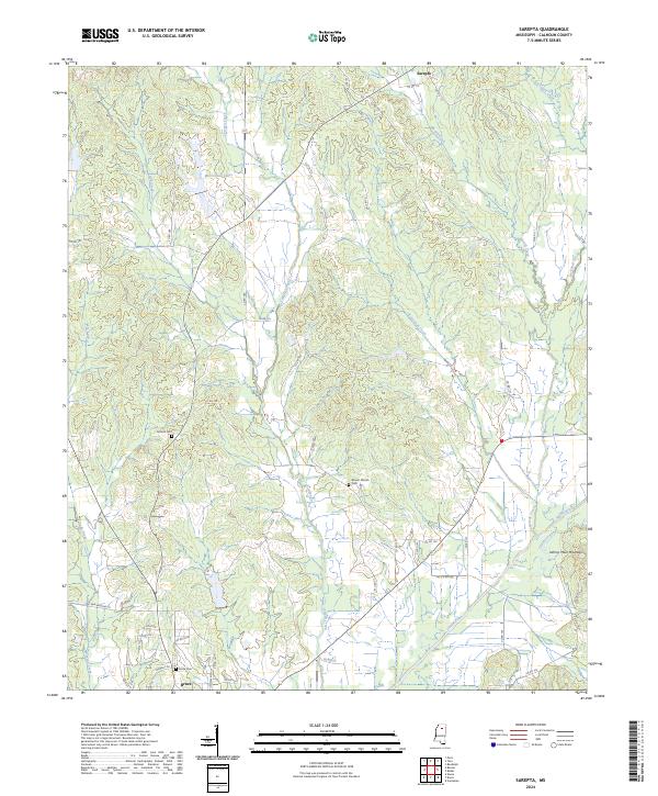
2024 Map of Sarepta
USGS Topo · Published 2024About this map
Sarepta sits at the northern edge of this landscape in Calhoun County, Mississippi, where the drainage systems of McGill Creek and Lucknuck Creek carve through the terrain. To the south, the city of Bruce marks a transition toward the broader valley of the Skuna River. This area is defined by its numerous small waterways, including Yoda Creek and Lick Creek, which feed into the river system. The presence of Moorehead Lakes and the distinct rise of Johnny Main Mountain in the southeast provide recognizable landmarks for local researchers. For those exploring family history, several burial grounds are preserved across the quadrangle, including Antioch Cem, Mount Moriah Cem, and Bruce Cem. The road network, comprised largely of county routes like Co RD 175 and Co RD 131, connects these rural homesteads and agricultural spaces, reflecting a long-standing pattern of settlement between the river and the northern uplands.
Find a feature on this map
53 named features on this map. Tap any name to fly to it.
Don’t see what you’re looking for? This feature index may not catch every label — zoom into the map to look around manually.
Map Details
Editions of this 2024 Sarepta Map
This is the sole edition of this map. No revisions or reprints were ever made.
Other maps of this area

1953 · West Point
USGS Topo · 1:250,000

1954 · Pittsboro
USGS Topo · 1:62,500

1956 · Tupelo
USGS Topo · 1:250,000

1958 · Tupelo
USGS Topo · 1:250,000

1958 · West Point
USGS Topo · 1:250,000

1963 · West Point
USGS Topo · 1:250,000

1972 · Paris
USGS Topo · 1:24,000

1972 · Robbs
USGS Topo · 1:24,000
1972 · Banner
USGS Topo · 1:24,000

1972 · Vardaman
USGS Topo · 1:24,000