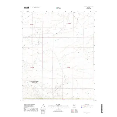
2020 Map of Sargent Ranch
USGS Topo · Published 2020About this map
Chaco Culture National Historical Park anchors the southern portion of this desert landscape, where the ancient geography is marked by Chaco Canyon and the prominent Chacra Mesa. The map records a network of ephemeral watercourses including Chaco Wash, Escavada Wash, and Gallo Wash that have carved the basin between San Juan and McKinley counties. Cultural presence is indicated by the Sargent Ranch and the Wijiji Trail, while the modern transportation infrastructure is defined by Co RD 7980 and Indian Svc Rte 456. The terrain is further defined by deep cuts like Sheep Camp Canyon, illustrating the drainage patterns that have shaped this high-elevation plateau region of the Eastern Navajo Agency.
Find a feature on this map
18 named features on this map. Tap any name to fly to it.
Don’t see what you’re looking for? This feature index may not catch every label — zoom into the map to look around manually.
Map Details
Editions of this 2020 Sargent Ranch Map
This is the sole edition of this map. No revisions or reprints were ever made.
Other maps of this area

1883 · Mt. Taylor
USGS Topo · 1:250,000

1886 · Mt. Taylor
USGS Topo · 1:250,000

1889 · Largo
USGS Topo · 1:250,000

1892 · Mt. Taylor
USGS Topo · 1:250,000

1895 · Largo
USGS Topo · 1:250,000

1899 · Mt. Taylor
USGS Topo · 1:250,000

1954 · Aztec
USGS Topo · 1:250,000

1958 · Aztec
USGS Topo · 1:250,000

1958 · Albuquerque
USGS Topo · 1:250,000
1961 · Pueblo Pintado
USGS Topo · 1:24,000