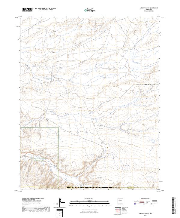
2023 Map of Sargent Ranch
USGS Topo · Published 2023About this map
Chaco Culture National Historical Park preserves a critical archaeological landscape where high desert plateaus meet the deep incisions of Chaco Canyon. This high-altitude drainage system is defined by a network of seasonal watercourses, including the Escavada Wash and Gallo Wash, which intersect the arid terrain of San Juan and McKinley Counties. The topographical record highlights the intricate canyon geography, most notably where Sheep Camp Canyon feeds into the primary wash system.
Find a feature on this map
17 named features on this map. Tap any name to fly to it.
Don’t see what you’re looking for? This feature index may not catch every label — zoom into the map to look around manually.
Map Details
Editions of this 2023 Sargent Ranch Map
This is the sole edition of this map. No revisions or reprints were ever made.
Other maps of this area

1883 · Mt. Taylor
USGS Topo · 1:250,000

1886 · Mt. Taylor
USGS Topo · 1:250,000

1889 · Largo
USGS Topo · 1:250,000

1892 · Mt. Taylor
USGS Topo · 1:250,000

1895 · Largo
USGS Topo · 1:250,000

1899 · Mt. Taylor
USGS Topo · 1:250,000

1954 · Aztec
USGS Topo · 1:250,000

1958 · Aztec
USGS Topo · 1:250,000

1958 · Albuquerque
USGS Topo · 1:250,000
1961 · Pueblo Pintado
USGS Topo · 1:24,000