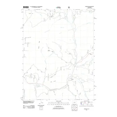
2011 Map of Sargents
USGS Topo · Published 2011About this map
Sargents sits at the heart of this high-altitude drainage basin, where the waters of Tomichi Creek meet the surrounding mountain gulches. The landscape is defined by its deep drainages and named ridges, including Dawson Ridge and the prominent Quakey Mountain. Significant transit routes through the high country are documented here, including the crossing at Black Sage Pass and the winding course of Long Branch Ave. This 2011 survey captures the area's role as a base for mountain recreation and forestry, featuring the Agate Campground and Tomichi Picnic Area. The intricate network of seasonal and perennial streams, such as Left Hand Dawson Creek and Marshall Creek, illustrates the complex hydrology that feeds the Gunnison River basin. These labels provide a detailed record of local nomenclature for the numerous gulches that carve into Steepy Mountain and Mount Yeckel, preserving the traditional names used by generations of ranchers and land managers.
Find a feature on this map
41 named features on this map. Tap any name to fly to it.
Don’t see what you’re looking for? This feature index may not catch every label — zoom into the map to look around manually.
Map Details
Editions of this 2011 Sargents Map
This is the sole edition of this map. No revisions or reprints were ever made.
Other maps of this area

1940 · Garfield
USGS Topo · 1:62,500

1941 · Pitkin
USGS Topo · 1:62,500

1945 · Pitkin
USGS Topo · 1:62,500

1945 · Garfield
USGS Topo · 1:62,500

1956 · Montrose
USGS Topo · 1:250,000

1959 · Montrose
USGS Topo · 1:250,000

1960 · Montrose
USGS Topo · 1:250,000

1962 · Doyleville
USGS Topo · 1:24,000

1962 · West Baldy
USGS Topo · 1:24,000
1964 · Pitkin
USGS Topo · 1:24,000