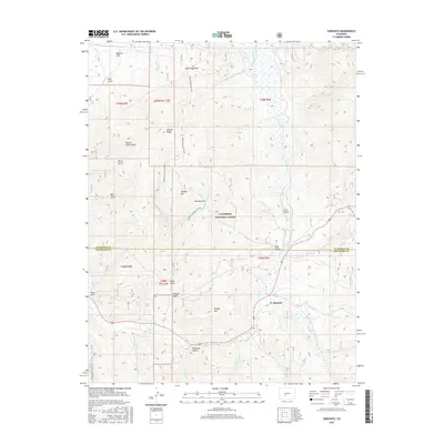
2016 Map of Sargents
USGS Topo · Published 2016About this map
Sargents sits at the southern edge of the Gunnison National Forest where the high-altitude hydrology of the Gunnison and Saguache county lines meets. This 2016 survey details a landscape defined by its historical alpine passages and drainage networks, most notably the crossing at Black Sage Pass. The terrain is deeply incised by numerous gulches that likely reflect early timber and mining exploration, including Sawmill Gulch, Deacon Jones Gulch, and Deadman Gulch.
Find a feature on this map
50 named features on this map. Tap any name to fly to it.
Don’t see what you’re looking for? This feature index may not catch every label — zoom into the map to look around manually.
Map Details
Editions of this 2016 Sargents Map
This is the sole edition of this map. No revisions or reprints were ever made.
Other maps of this area

1940 · Garfield
USGS Topo · 1:62,500

1941 · Pitkin
USGS Topo · 1:62,500

1945 · Pitkin
USGS Topo · 1:62,500

1945 · Garfield
USGS Topo · 1:62,500

1956 · Montrose
USGS Topo · 1:250,000

1959 · Montrose
USGS Topo · 1:250,000

1960 · Montrose
USGS Topo · 1:250,000

1962 · Doyleville
USGS Topo · 1:24,000

1962 · West Baldy
USGS Topo · 1:24,000
1964 · Pitkin
USGS Topo · 1:24,000