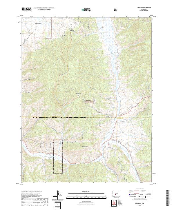
2022 Map of Sargents
USGS Topo · Published 2022About this map
The settlement of Sargents sits at a critical junction of high-altitude drainages and historical travel corridors within the Gunnison National Forest. Located where Tomichi Cr meets Marshall Cr, this area is defined by the high peaks of the Sawatch Range and the prominent volcanic terrain of Quakey Mtn and Steepy Mtn. The landscape is a complex network of drainages such as Agate Cr and Waddle Cr, long used as natural pathways through the mountains.
Find a feature on this map
54 named features on this map. Tap any name to fly to it.
Don’t see what you’re looking for? This feature index may not catch every label — zoom into the map to look around manually.
Map Details
Editions of this 2022 Sargents Map
This is the sole edition of this map. No revisions or reprints were ever made.
Other maps of this area

1940 · Garfield
USGS Topo · 1:62,500

1941 · Pitkin
USGS Topo · 1:62,500

1945 · Pitkin
USGS Topo · 1:62,500

1945 · Garfield
USGS Topo · 1:62,500

1956 · Montrose
USGS Topo · 1:250,000

1959 · Montrose
USGS Topo · 1:250,000

1960 · Montrose
USGS Topo · 1:250,000

1962 · Doyleville
USGS Topo · 1:24,000

1962 · West Baldy
USGS Topo · 1:24,000
1964 · Pitkin
USGS Topo · 1:24,000