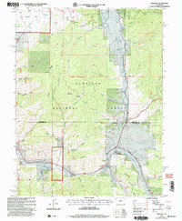
2001 Map of Sargents
USGS Topo · Published 2004About this map
Waunita Park and the settlement of Sargents anchor this high-elevation landscape within the Gunnison National Forest. The map documents a complex drainage network where Tomichi Creek receives numerous tributaries, including Agate Creek and Marshall Pass Road following the local topography. This 2001 revision highlights the intersection of historic transit routes and resource extraction, with multiple Prospects and a Gravel Pit noted near Black Sage Pass.
Find a feature on this map
47 named features on this map. Tap any name to fly to it.
Don’t see what you’re looking for? This feature index may not catch every label — zoom into the map to look around manually.
Map Details
Editions of this 2001 Sargents Map
This is the sole edition of this map. No revisions or reprints were ever made.
Other maps of this area

1940 · Garfield
USGS Topo · 1:62,500

1941 · Pitkin
USGS Topo · 1:62,500

1945 · Pitkin
USGS Topo · 1:62,500

1945 · Garfield
USGS Topo · 1:62,500

1956 · Montrose
USGS Topo · 1:250,000

1959 · Montrose
USGS Topo · 1:250,000

1960 · Montrose
USGS Topo · 1:250,000

1962 · Doyleville
USGS Topo · 1:24,000

1962 · West Baldy
USGS Topo · 1:24,000
1964 · Pitkin
USGS Topo · 1:24,000