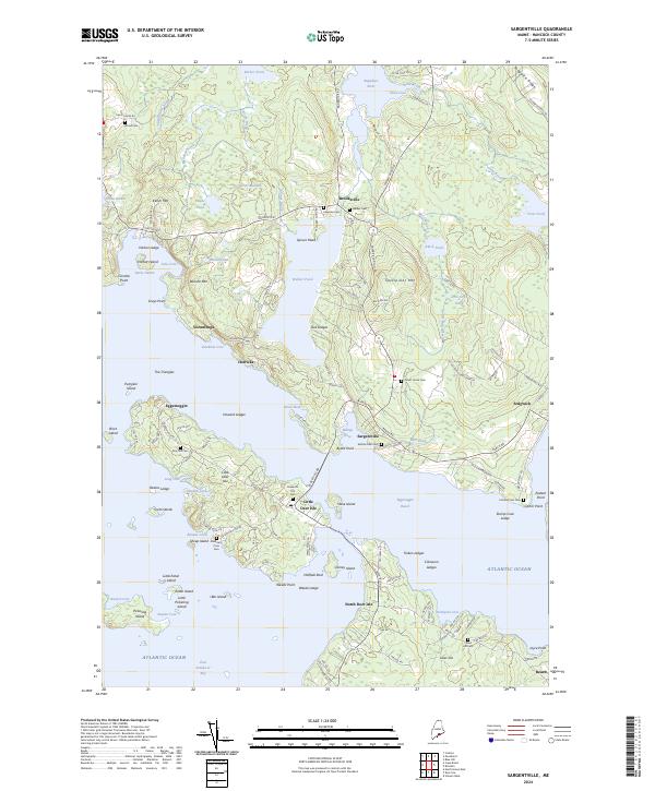
2024 Map of Sargentville
USGS Topo · Published 2024About this map
Sargentville and the surrounding coastal communities of Brooksville and Sedgwick define this maritime landscape along the Eggemoggin Reach. The complex coastline is marked by numerous sheltered harbors and coves, including Bucks Harbor, Billings Cove, and Deadman Cove. Settlement patterns follow the winding roads along the water, such as Coastal Rd and Reach Rd, leading to historic burying grounds like Settlers Rest Cem and Forest Home Cem. Inland, the terrain rises significantly at Caterpillar Mtn and Winche Mtn, while Walker Pond and Black Pond provide large freshwater basins near the shore. The connection between the mainland and Little Deer Isle is a central feature, illustrating the geography of the Penobscot Bay region where seafaring history and small-town life intersect.
Find a feature on this map
147 named features on this map. Tap any name to fly to it.
Don’t see what you’re looking for? This feature index may not catch every label — zoom into the map to look around manually.
Map Details
Editions of this 2024 Sargentville Map
This is the sole edition of this map. No revisions or reprints were ever made.
Other maps of this area

1902 · Castine
USGS Topo · 1:62,500

1904 · Deer Isle
USGS Topo · 1:62,500

1904 · Castine
USGS Topo · 1:62,500

1904 · Bluehill
USGS Topo · 1:62,500

1904 · Vinalhaven
USGS Topo · 1:62,500

1905 · Penobscot Bay
USGS Topo · 1:125,000

1941 · Castine
USGS Topo · 1:62,500

1941 · Vinalhaven
USGS Topo · 1:62,500

1942 · Deer Isle
USGS Topo · 1:62,500
1943 · Castine
USGS Topo · 1:62,500