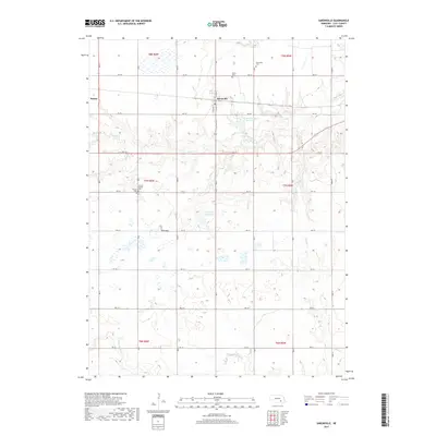
2017 Map of Saronville
USGS Topo · Published 2017About this map
Saronville serves as a central hub in this Clay County landscape, where the rectilinear grid of rural roads meets the gentle drainages of School Cr and Little Sandy Cr. The area is defined by its agricultural legacy, with small settlements like Verona and a portion of Sutton marking the prairie. Genealogists will find significant value in the placement of several local burial grounds, including the Saronville Cem, Verona Cem, and Saron Cem, alongside the Verona Baptist church. The presence of water management features such as Percival-Erickson Reservoir and Schmer Reservoir reflects the intensive land use of the Nebraska plains. This survey documents the intersection of rural life and natural hydrology, illustrating how the townships are organized across the rolling terrain of south-central Nebraska.
Find a feature on this map
36 named features on this map. Tap any name to fly to it.
Don’t see what you’re looking for? This feature index may not catch every label — zoom into the map to look around manually.
Map Details
Editions of this 2017 Saronville Map
This is the sole edition of this map. No revisions or reprints were ever made.
Other maps of this area

1898 · York
USGS Topo · 1:125,000

1898 · Superior
USGS Topo · 1:125,000

1898 · Hebron
USGS Topo · 1:125,000

1898 · Grand Island
USGS Topo · 1:125,000

1899 · York
USGS Topo · 1:125,000

1955 · Lincoln
USGS Topo · 1:250,000

1955 · Grand Island
USGS Topo · 1:250,000

1957 · Lincoln
USGS Topo · 1:250,000

1957 · Grand Island
USGS Topo · 1:250,000

1958 · Grand Island
USGS Topo · 1:250,000