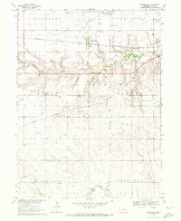
1969 Map of Saronville
USGS Topo · Published 1971About this map
Saronville and the surrounding clay plains of central Nebraska are captured here during a period of steady agricultural production and rail transport. The Burlington Northern railroad serves as the primary east-west corridor, connecting the small elevators and homes of Saronville and Verona. The landscape is defined by the headwaters of several drainages, including School Creek and Turkey Creek, which carve gentle patterns across the otherwise flat township blocks of Lewis and El Dorado.
Find a feature on this map
21 named features on this map. Tap any name to fly to it.
Don’t see what you’re looking for? This feature index may not catch every label — zoom into the map to look around manually.
Map Details
Editions of this 1969 Saronville Map
This is the sole edition of this map. No revisions or reprints were ever made.
Other maps of this area

1898 · York
USGS Topo · 1:125,000

1898 · Superior
USGS Topo · 1:125,000

1898 · Hebron
USGS Topo · 1:125,000

1898 · Grand Island
USGS Topo · 1:125,000

1899 · York
USGS Topo · 1:125,000

1955 · Lincoln
USGS Topo · 1:250,000

1955 · Grand Island
USGS Topo · 1:250,000

1957 · Lincoln
USGS Topo · 1:250,000

1957 · Grand Island
USGS Topo · 1:250,000

1958 · Grand Island
USGS Topo · 1:250,000