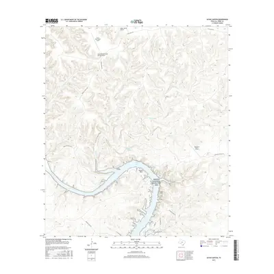
2016 Map of Satan Canyon
USGS Topo · Published 2016About this map
The Amistad National Recreation Area dominates the southern landscape of this Val Verde County region, where the reservoir waters fill the deep-cut channels of the Devils River system. This 2016 survey documents a rugged, arid terrain defined by complex drainages like Big Satan Cr and Little Satan Cr, leading into the prominent Satan Canyon. Significant hydrologic features such as Walk Lake, Slaughter Bend, and various upland water sources like Lowry Springs and Indian Springs highlight the importance of water management and access in this desert environment.
Find a feature on this map
22 named features on this map. Tap any name to fly to it.
Don’t see what you’re looking for? This feature index may not catch every label — zoom into the map to look around manually.
Map Details
Editions of this 2016 Satan Canyon Map
This is the sole edition of this map. No revisions or reprints were ever made.
Other maps of this area

1941 · Feely
USGS Topo · 1:62,500

1944 · Dry Devil
USGS Topo · 1:62,500

1944 · Devils Lake
USGS Topo · 1:62,500

1944 · Baker Crossing
USGS Topo · 1:62,500

1958 · Del Rio
USGS Topo · 1:250,000

1964 · Del Rio
USGS Topo · 1:250,000

1972 · California Creek
USGS Topo · 1:24,000

1972 · Miers Ranch
USGS Topo · 1:24,000

1972 · Rough Canyon SE
USGS Topo · 1:24,000
1972 · Satan Canyon
USGS Topo · 1:24,000