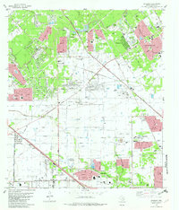
1982 Map of Satsuma
USGS Topo · Published 1982About this map
Cypress Creek and Whiteoak Bayou weave through this suburbanizing landscape of northwest Harris County, where residential developments like Greenwood Forest and Champions are seen expanding into former open lands. The map documents a period of significant growth, evidenced by numerous schools such as Bleyil Jr High Sch and large-scale infrastructure like the Wharton Powerplant and the Cypress-Fairbanks Stadium.
Find a feature on this map
43 named features on this map. Tap any name to fly to it.
Don’t see what you’re looking for? This feature index may not catch every label — zoom into the map to look around manually.
Map Details
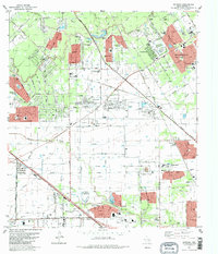
Editions of this 1982 Satsuma Map
2 editions found
Other maps of this area

1915 · Houston Heights
USGS Topo · 1:24,000

1915 · Cypress
USGS Topo · 1:24,000

1915 · Addicks
USGS Topo · 1:24,000

1915 · Hillendahl
USGS Topo · 1:24,000

1916 · Rose Hill
USGS Topo · 1:24,000

1916 · Aldine
USGS Topo · 1:24,000

1916 · Louetta
USGS Topo · 1:24,000

1916 · Satsuma
USGS Topo · 1:24,000

1916 · Spring
USGS Topo · 1:24,000

1918 · Cypress
USGS Topo · 1:31,680