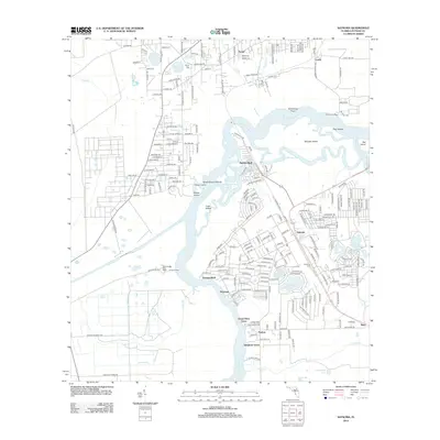
2012 Map of Satsuma
USGS Topo · Published 2012About this map
The Saint Johns River defines this portion of Putnam County, winding through a complex network of wetlands and islands. The settlement of Satsuma sits inland from the riverbank, surrounded by a high concentration of small lakes and ponds such as Lake Mura, Castle Lake, and Saratoga Lake. To the north, the landscape transitions into the rural communities of Peniel and Lundy, where Peniel Cem provides a point of interest for local historians and genealogists.
Find a feature on this map
235 named features on this map. Tap any name to fly to it.
Don’t see what you’re looking for? This feature index may not catch every label — zoom into the map to look around manually.
Map Details
Editions of this 2012 Satsuma Map
This is the sole edition of this map. No revisions or reprints were ever made.
Other maps of this area

1912 · Palatka
USGS Topo · 1:48,000

1915 · Palatka
USGS Topo · 1:62,500

1915 · Interlachen
USGS Topo · 1:48,000

1916 · Interlachen
USGS Topo · 1:62,500

1944 · Interlachen
USGS Topo · 1:62,500

1949 · Baywood
USGS Topo · 1:24,000

1949 · Rodman
USGS Topo · 1:24,000

1949 · Interlachen
USGS Topo · 1:62,500

1954 · Daytona Beach
USGS Topo · 1:250,000

1958 · Daytona Beach
USGS Topo · 1:250,000