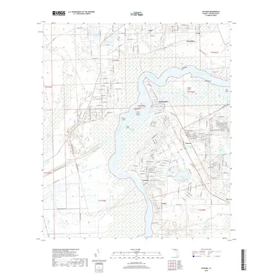
2018 Map of Satsuma
USGS Topo · Published 2018About this map
The Saint Johns River defines the geography of this Putnam County region, winding past riverside settlements and several named islands including Murphy Island and Stokes Island. This modern survey highlights a complex network of wetlands and inland water bodies such as Silver Lake and Lake Myra. Notable for local history and genealogy are the Satsuma Cem and Peniel Cem, which serve the small communities of Satsuma, Peniel, and Nashua. The northern portion of the Cross Florida Barge Canal is visible, cutting through the landscape south of Buffalo Bluff. These waterways and the surrounding marshes are interconnected by smaller channels like Murphy Creek and Dunns Creek, illustrating the aquatic nature of the landscape near Palatka. The map provides a clear record of residential development and road networks as they existed in the late 2010s.
Find a feature on this map
102 named features on this map. Tap any name to fly to it.
Don’t see what you’re looking for? This feature index may not catch every label — zoom into the map to look around manually.
Map Details
Editions of this 2018 Satsuma Map
This is the sole edition of this map. No revisions or reprints were ever made.
Other maps of this area

1912 · Palatka
USGS Topo · 1:48,000

1915 · Palatka
USGS Topo · 1:62,500

1915 · Interlachen
USGS Topo · 1:48,000

1916 · Interlachen
USGS Topo · 1:62,500

1944 · Interlachen
USGS Topo · 1:62,500

1949 · Baywood
USGS Topo · 1:24,000

1949 · Rodman
USGS Topo · 1:24,000

1949 · Interlachen
USGS Topo · 1:62,500

1954 · Daytona Beach
USGS Topo · 1:250,000

1958 · Daytona Beach
USGS Topo · 1:250,000