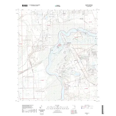
2021 Map of Satsuma
USGS Topo · Published 2021About this map
The Saint Johns River winds through this Putnam County landscape, defining the character of riverfront settlements like Buffalo Bluff, Satsuma, and Nashua. These communities are situated along the eastern bank, where the land rises slightly above the river's extensive marsh systems. The interior reveals a dense network of water bodies, including Saratoga Lake, Castle Lake, and the larger Silver Lake to the north. A significant modern geographic feature is the Cross Florida Barge Canal, which cuts westward across the terrain toward Cow Heaven Bay. Local history and genealogy are anchored by the Peniel Cem near the settlement of Peniel and the Satsuma Cem near the river. Large protected areas like the Caravelle Ranch Wildlife Management Area Trl and Murphy Island preserve the wetland character of the region, while the Florida National Scenic Trl provides a pedestrian route through the western corridor.
Find a feature on this map
200 named features on this map. Tap any name to fly to it.
Don’t see what you’re looking for? This feature index may not catch every label — zoom into the map to look around manually.
Map Details
Editions of this 2021 Satsuma Map
This is the sole edition of this map. No revisions or reprints were ever made.
Other maps of this area

1912 · Palatka
USGS Topo · 1:48,000

1915 · Palatka
USGS Topo · 1:62,500

1915 · Interlachen
USGS Topo · 1:48,000

1916 · Interlachen
USGS Topo · 1:62,500

1944 · Interlachen
USGS Topo · 1:62,500

1949 · Baywood
USGS Topo · 1:24,000

1949 · Rodman
USGS Topo · 1:24,000

1949 · Interlachen
USGS Topo · 1:62,500

1954 · Daytona Beach
USGS Topo · 1:250,000

1958 · Daytona Beach
USGS Topo · 1:250,000