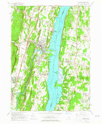
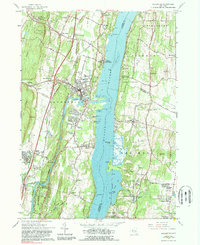
1963 Map of Saugerties
USGS Topo · Published 1965About this map
Esopus Creek winds through the heart of this Hudson Valley landscape, meeting the Hudson River at the industrial and residential hub of Saugerties. This mid-century survey reveals a corridor defined by religious and educational institutions, from the Assumptionist Fathers Monastery and Dominican Sisters Convent on the western shore to the expansive grounds of Bard College at Annandale-on-Hudson to the east.
Find a feature on this map
78 named features on this map. Tap any name to fly to it.
Don’t see what you’re looking for? This feature index may not catch every label — zoom into the map to look around manually.
Map Details
Editions of this 1963 Saugerties Map
5 editions found
Other maps of this area

1892 · Kaaterskill
USGS Topo · 1:62,500

1893 · Kaaterskill
USGS Topo · 1:62,500

1894 · Kaaterskill
USGS Topo · 1:62,500

1895 · Catskill
USGS Topo · 1:62,500

1898 · Rhinebeck
USGS Topo · 1:62,500

1899 · Kaaterskill
USGS Topo · 1:62,500

1901 · Rosendale
USGS Topo · 1:62,500

1903 · Rosendale
USGS Topo · 1:62,500

1903 · Kaaterskill
USGS Topo · 1:62,500

1934 · Rhinebeck
USGS Topo · 1:48,000