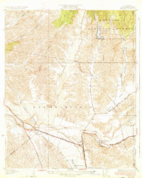
1933 Map of Saugus
USGS Topo · Published 1933About this map
Saugus serves as a central hub for transportation and infrastructure in this transition between the valley floor and the high desert. The confluence of the Santa Clara River and Placerita Creek marks a landscape defined by critical early 20th-century utilities, including an extensive Aqueduct and numerous transmission lines. Aviation history is particularly prominent here, evidenced by the Dept. of Commerce Landing Field and an Airway Beacon, which guided pilots through these mountain passes before modern radar.
Find a feature on this map
27 named features on this map. Tap any name to fly to it.
Don’t see what you’re looking for? This feature index may not catch every label — zoom into the map to look around manually.
Map Details
Editions of this 1933 Saugus Map
4 editions found
Other maps of this area

1900 · Fernando
USGS Topo · 1:62,500

1901 · Southern California Sheet No. 1
USGS Topo · 1:250,000

1903 · Tejon
USGS Topo · 1:125,000

1903 · Camulos
USGS Topo · 1:125,000

1903 · Santa Susana
USGS Topo · 1:62,500

1904 · Southern California Sheet No. 1
USGS Topo · 1:250,000

1915 · Elizabeth Lake
USGS Topo · 1:125,000

1917 · Elizabeth Lake
USGS Topo · 1:125,000

1925 · Sylmar
USGS Topo · 1:24,000

1928 · Sylmar
USGS Topo · 1:24,000
Featured Places
- Santa Clarita, CA
- Pardee, Santa Clarita
- Rancho Santa Clarita, Santa Clarita
- Bouquet Junction, Santa Clarita
- Los Angeles County, CA