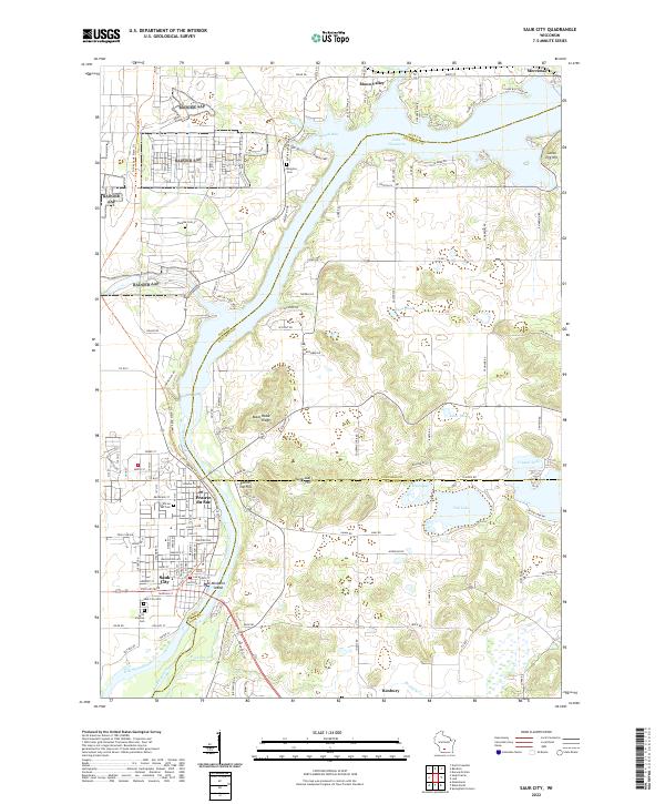
2022 Map of Sauk City
USGS Topo · Published 2022About this map
Sauk City and Prairie du Sac anchor this reach of the Wisconsin River, situated where the river transitions from the wide expanse of Lake Wisconsin into a more defined southern channel. The landscape is punctuated by prominent terrain features such as Black Hawk Ridge, Goose Egg Hill, and Sugarloaf Hill, reflecting the complex glacial topography of the region. Multiple cemeteries, including Saint Aloysius Cem and the Kingston Cem, provide essential data points for genealogical research across Sauk, Columbia, and Dane counties. To the east, smaller water bodies like Fish Lake and Crystal Lake dot the countryside near Roxbury, while Wiegands Bay marks a significant inlet on the lake. This survey documents the established road network and land divisions at the start of the 2020s, illustrating the continued significance of the river in shaping local settlement patterns.
Find a feature on this map
136 named features on this map. Tap any name to fly to it.
Don’t see what you’re looking for? This feature index may not catch every label — zoom into the map to look around manually.
Map Details
Editions of this 2022 Sauk City Map
This is the sole edition of this map. No revisions or reprints were ever made.
Other maps of this area

1895 · Baraboo
USGS Topo · 1:62,500

1901 · Denzer
USGS Topo · 1:62,500

1907 · Cross Plains
USGS Topo · 1:62,500

1908 · Baraboo
USGS Topo · 1:62,500

1909 · Cross Plains
USGS Topo · 1:62,500

1920 · Blue Mounds
USGS Topo · 1:62,500

1922 · Blue Mounds
USGS Topo · 1:62,500

1957 · Madison
USGS Topo · 1:250,000

1958 · North Freedom
USGS Topo · 1:62,500

1959 · Baraboo
USGS Topo · 1:62,500