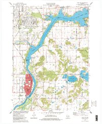
1975 Map of Sauk City
USGS Topo · Published 1978About this map
The Wisconsin River dominates this landscape, carving through the heart of the region and forming prominent water features like Wiegands Bay. Along its western banks, the industrial footprint of the Badger Army Ammunition Plant occupies a massive area, characterized by its dense grid of roads and specialized facility structures. This mid-1970s survey illustrates a moment when heavy military manufacturing coexisted with local recreation and conservation efforts, such as the Mazomanie State Wildlife Area to the south.
Find a feature on this map
9 named features on this map. Tap any name to fly to it.
Don’t see what you’re looking for? This feature index may not catch every label — zoom into the map to look around manually.
Map Details
Editions of this 1975 Sauk City Map
This is the sole edition of this map. No revisions or reprints were ever made.
Other maps of this area

1895 · Baraboo
USGS Topo · 1:62,500

1901 · Denzer
USGS Topo · 1:62,500

1907 · Cross Plains
USGS Topo · 1:62,500

1908 · Baraboo
USGS Topo · 1:62,500

1909 · Cross Plains
USGS Topo · 1:62,500

1920 · Blue Mounds
USGS Topo · 1:62,500

1922 · Blue Mounds
USGS Topo · 1:62,500

1957 · Madison
USGS Topo · 1:250,000

1958 · North Freedom
USGS Topo · 1:62,500

1959 · Baraboo
USGS Topo · 1:62,500