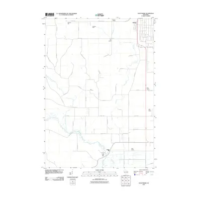
2010 Map of Sauk Prairie
USGS Topo · Published 2010About this map
Otter Creek meanders southward toward its confluence with Honey Creek, anchoring a landscape defined by significant elevation changes and rural community markers in the early 21st century. The map highlights the prominent northern ridgeline featuring Hogback Hill, Dinosaur Bluff, and the protected area of Baxters Hollow. This terrain falls away to the south and east, where the settlement of Bluffview and the Sauk-Prairie Airport suggest a transition toward more developed corridors.
Find a feature on this map
51 named features on this map. Tap any name to fly to it.
Don’t see what you’re looking for? This feature index may not catch every label — zoom into the map to look around manually.
Map Details
Editions of this 2010 Sauk Prairie Map
This is the sole edition of this map. No revisions or reprints were ever made.
Other maps of this area

1895 · Baraboo
USGS Topo · 1:62,500

1901 · Denzer
USGS Topo · 1:62,500

1907 · Cross Plains
USGS Topo · 1:62,500

1908 · Baraboo
USGS Topo · 1:62,500

1909 · Cross Plains
USGS Topo · 1:62,500

1920 · Blue Mounds
USGS Topo · 1:62,500

1922 · Blue Mounds
USGS Topo · 1:62,500

1957 · Madison
USGS Topo · 1:250,000

1958 · North Freedom
USGS Topo · 1:62,500

1959 · Baraboo
USGS Topo · 1:62,500
Featured Places
- Prairie du Sac, WI
- Honey Creek, WI
- Town of Prairie du Sac, Prairie du Sac
- Prairie du Sac, WI
- Sumpter, WI