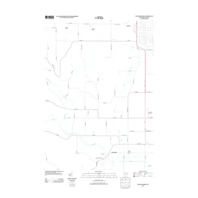
2013 Map of Sauk Prairie
USGS Topo · Published 2013About this map
Bluffview and Loddes Mill anchor this part of Sauk County, where the landscape transitions from agricultural plains to the distinctive relief of Dinosaur Bluff and Hogback Hill. The map documents a complex drainage network dominated by Honey Creek and its eastern branch, alongside Otter Cr, which meanders toward the southern bluffs. Transportation corridors such as Us-12 and the historic path of Old Bluff Trl define the local movement, while Sauk-Prairie Airport provides a modern landmark near the eastern edge. Local genealogists may find interest in the network of family-named roads like Swiss Valley Rd, Von Wald Rd, and Matouschek Rd, which reflect the area's deep-rooted heritage. The terrain is notably marked by Loddes Mill Bluff, overlooking the site of the former mill and the convergence of local waterways.
Find a feature on this map
55 named features on this map. Tap any name to fly to it.
Don’t see what you’re looking for? This feature index may not catch every label — zoom into the map to look around manually.
Map Details
Editions of this 2013 Sauk Prairie Map
This is the sole edition of this map. No revisions or reprints were ever made.
Other maps of this area

1895 · Baraboo
USGS Topo · 1:62,500

1901 · Denzer
USGS Topo · 1:62,500

1907 · Cross Plains
USGS Topo · 1:62,500

1908 · Baraboo
USGS Topo · 1:62,500

1909 · Cross Plains
USGS Topo · 1:62,500

1920 · Blue Mounds
USGS Topo · 1:62,500

1922 · Blue Mounds
USGS Topo · 1:62,500

1957 · Madison
USGS Topo · 1:250,000

1958 · North Freedom
USGS Topo · 1:62,500

1959 · Baraboo
USGS Topo · 1:62,500
Featured Places
- Prairie du Sac, WI
- Honey Creek, WI
- Town of Prairie du Sac, Prairie du Sac
- Prairie du Sac, WI
- Sumpter, WI