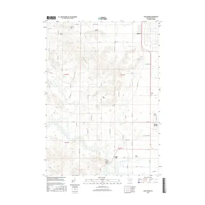
2016 Map of Sauk Prairie
USGS Topo · Published 2016About this map
Prairie du Sac anchors the southeastern corner of this landscape, where the terrain shifts from the agricultural lowlands of the Sauk Prairie into the prominent ridges of the South Range. The area is defined by sharp elevation changes, most notably at Dinosaur Bluff and Loddes Mill Bluff, which overlook the winding course of Honey Creek and Otter Creek. These waterways and their branches, such as the East Branch Honey Creek, carve through the rural countryside, dictating the placement of early road networks like Old Bluff Trail and Kings Corner Road.
Find a feature on this map
66 named features on this map. Tap any name to fly to it.
Don’t see what you’re looking for? This feature index may not catch every label — zoom into the map to look around manually.
Map Details
Editions of this 2016 Sauk Prairie Map
This is the sole edition of this map. No revisions or reprints were ever made.
Other maps of this area

1895 · Baraboo
USGS Topo · 1:62,500

1901 · Denzer
USGS Topo · 1:62,500

1907 · Cross Plains
USGS Topo · 1:62,500

1908 · Baraboo
USGS Topo · 1:62,500

1909 · Cross Plains
USGS Topo · 1:62,500

1920 · Blue Mounds
USGS Topo · 1:62,500

1922 · Blue Mounds
USGS Topo · 1:62,500

1957 · Madison
USGS Topo · 1:250,000

1958 · North Freedom
USGS Topo · 1:62,500

1959 · Baraboo
USGS Topo · 1:62,500
Featured Places
- Prairie du Sac, WI
- Honey Creek, WI
- Town of Prairie du Sac, Prairie du Sac
- Prairie du Sac, WI
- Sumpter, WI