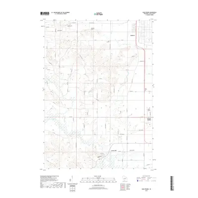
2018 Map of Sauk Prairie
USGS Topo · Published 2018About this map
Prairie du Sac sits along the southeastern edge of this landscape, where the flat plains meet the complex topography of the South Range and Hogback Hill. The map documents a blend of agricultural infrastructure and distinctive geological formations, such as Dinosaur Bluff and Loddes Mill Bluff. Several small clusters of development like Bluffview and Loddes Mill are connected by a network of rural roads including Old Bluff Trl and Swiss Valley Rd. For local historians and genealogists, the placement of Otter Creek Cem, Zion Cem, and the Sauk Prairie Cem offers precise locations for family research. The drainage patterns of Honey Creek and its branches, alongside Otter Cr, illustrate the natural irrigation that has long defined this part of Sauk County.
Find a feature on this map
61 named features on this map. Tap any name to fly to it.
Don’t see what you’re looking for? This feature index may not catch every label — zoom into the map to look around manually.
Map Details
Editions of this 2018 Sauk Prairie Map
This is the sole edition of this map. No revisions or reprints were ever made.
Other maps of this area

1895 · Baraboo
USGS Topo · 1:62,500

1901 · Denzer
USGS Topo · 1:62,500

1907 · Cross Plains
USGS Topo · 1:62,500

1908 · Baraboo
USGS Topo · 1:62,500

1909 · Cross Plains
USGS Topo · 1:62,500

1920 · Blue Mounds
USGS Topo · 1:62,500

1922 · Blue Mounds
USGS Topo · 1:62,500

1957 · Madison
USGS Topo · 1:250,000

1958 · North Freedom
USGS Topo · 1:62,500

1959 · Baraboo
USGS Topo · 1:62,500
Featured Places
- Prairie du Sac, WI
- Honey Creek, WI
- Town of Prairie du Sac, Prairie du Sac
- Prairie du Sac, WI
- Sumpter, WI