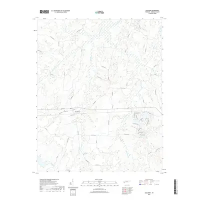
2019 Map of Saulsbury
USGS Topo · Published 2019About this map
Saulsbury serves as the focal point of this Tennessee landscape, where the headwaters of numerous creeks diverge across the Hardeman County countryside. The area is defined by its water systems, including the Spring Creek drainage and the Saulsbury Cr basin. Local genealogy is well-supported by the documentation of family-named burial sites such as Pruette Cem, Wright Cem, and Antioch Cem. Residential developments like Catherine Hts and the neighborhood surrounding Crystal Lake show the modern footprint of the community. A dense network of local roads, such as Edwin Harris Rd and Van Buren Rd, connects the scattered farms and homesteads. The terrain is notably dissected by small tributaries like Dry Br, Kellum Br, and Cash Cr, illustrating the intricate drainage patterns that have shaped the region's agricultural history and land use for generations.
Find a feature on this map
58 named features on this map. Tap any name to fly to it.
Don’t see what you’re looking for? This feature index may not catch every label — zoom into the map to look around manually.
Map Details
Editions of this 2019 Saulsbury Map
This is the sole edition of this map. No revisions or reprints were ever made.
Other maps of this area

1950 · Ashland
USGS Topo · 1:62,500

1950 · Hebron
USGS Topo · 1:24,000

1950 · Middleburg
USGS Topo · 1:24,000

1950 · Middleton
USGS Topo · 1:24,000

1950 · Grand Junction
USGS Topo · 1:24,000

1951 · Middleton
USGS Topo · 1:24,000

1951 · Middleburg
USGS Topo · 1:24,000

1951 · Hebron
USGS Topo · 1:24,000

1951 · Hickory Valley
USGS Topo · 1:24,000

1951 · Grand Junction
USGS Topo · 1:24,000